
 | ||
Restaurants Chavela's, Berg'n, Glady's, Boeuf & Bun, Mayfield Hotels Best Western Plus Aren, Hotel Lynx, La Quinta Inn & Suites Br, Eshel Hotel, Utica Inn and Hostel | ||
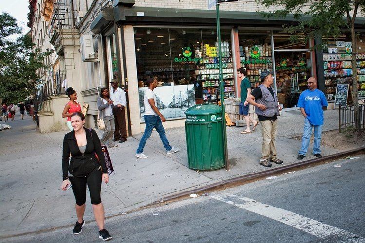
New york neighborhood tour crown heights brooklyn
Crown Heights is a neighborhood in the central portion of the New York City borough of Brooklyn. The main thoroughfare through this neighborhood is Eastern Parkway, a tree-lined boulevard designed by Frederick Law Olmsted extending 2 miles (3.2 kilometres) east–west. Originally, the area was known as Crow Hill. It was a succession of hills running east and west from Utica Avenue to Washington Avenue, and south to Empire Boulevard and East New York Avenue. The name was changed when Crown Street was cut through in 1916.
Contents
- New york neighborhood tour crown heights brooklyn
- Map of Crown Heights Brooklyn NY USA
- Early history
- Early and mid 20th century
- Late 20th century
- Early 21st century
- Demographics
- Political representation
- Education
- Transportation
- Recreation
- Landmarks
- In film
- References
Map of Crown Heights, Brooklyn, NY, USA
Crown Heights is bounded by Washington Avenue to the west, Atlantic Avenue to the north, Ralph Avenue to the east, and Empire Boulevard/East New York Avenue to the south. It is about 1 mile (1.6 km) wide and 2 miles (3.2 km) long. Neighborhoods bordering Crown Heights include Prospect Heights to the west, Flatbush and Prospect Lefferts Gardens to the south, Brownsville to the east, and Bedford-Stuyvesant to the north.
The neighborhood extends through much of Brooklyn Community Board 8 and 9. It is under the jurisdiction of two precincts of the New York City Police Department. The 77th Precinct is part of Brooklyn North, which covers Crown Heights, Prospect Heights and Weeksville. The 71st Precinct is part of Brooklyn South and covers the southern end of Crown Heights.
Early history
Although no known physical evidence remains in the Crown Heights vicinity, large portions of what is now called Long Island including present-day Brooklyn were occupied by the Lenape, (later renamed Delaware Indians by the European colonizers). The Lenape lived in communities of bark- or grass-covered wigwams, and in their larger settlements—typically located on high ground adjacent to fresh water, and occupied in the fall, winter, and spring—they fished, harvested shellfish, trapped animals, gathered wild fruits and vegetables, and cultivated corn, tobacco, beans, and other crops.
The first recorded contact between the indigenous people of the New York City region and Europeans was with the Italian explorer Giovanni da Verrazzano in 1524 in the service of France when he anchored at the approximate location where the Verrazano-Narrows Bridge touches down in Brooklyn today. There he was visited by a canoe party of Lenape. The next contact was in 1609 when the explorer Henry Hudson arrived in what is now New York Harbor aboard a Dutch East India Company ship, the Halve Maen (Half Moon) commissioned by the Dutch Republic.
European habitation in the New York City area began in earnest with the founding of a Dutch fur trading settlement, later called "Nieuw Amsterdam" (New Amsterdam), on the southern tip of Manhattan in 1614. By 1630, Dutch and English colonists started moving into the western end of Long Island. In 1637, Joris Jansen de Rapalje purchased about 335 acres (1.36 km2) around Wallabout Bay and over the following two years, director Kieft of the Dutch West India Company purchased title to nearly all the land in what is now Kings County and Queens County from the indigenous inhabitants.
Finally, the areas around present-day Crown Heights saw its first European settlements starting in about 1661/1662 when several men each received, from Governor Peter Stuyvesant and the directors of the Dutch West India Company what was described as “a parcel of free (unoccupied) woodland there” on the condition that they situate their houses “within one of the other concentration, which would suit them best, but not to make a hamlet.”
Early and mid-20th century
Crown Heights had begun as a posh residential neighborhood, a place for secondary homes in which Manhattan's growing bourgeois class could reside. The area benefited by having its rapid transit in a subway configuration, the IRT Eastern Parkway Line (2 3 4 5 trains), in contrast to many other Brooklyn neighborhoods, which had elevated lines. Conversion to a commuter town also included tearing down the 19th century Kings County Penitentiary at Carroll Street and Nostrand Avenue.
Beginning in the early 1900s, many upper-class residences, including characteristic brownstone buildings, were erected along Eastern Parkway. Away from the parkway were a mixture of lower middle-class residences. This development peaked in the 1920s. Before World War II Crown Heights was among New York City's premier neighborhoods, with tree-lined streets, an array of cultural institutions and parks, and numerous fraternal, social and community organizations.
From the early 1920s through the 1960s, Crown Heights was an overwhelmingly white neighborhood and predominantly Jewish. Population changes began in the 1920s with newcomers from Jamaica and the West Indies, as well as African Americans from the South. In 1950, the neighborhood was 89 percent white, with some 50 to 60 percent of the white population, or about 75,000 people, being Jewish, and a small, growing black population. By 1957, there were about 25,000 blacks in Crown Heights, making up about one-fourth of the population. There were thirty-four large synagogues in the neighborhood, including the Bobov, Chovevei Torah, and 770 Eastern Parkway, home of the worldwide Lubavitch movement. There were also three prominent Yeshiva elementary schools in the neighborhood, Crown Heights Yeshiva on Crown Street, the Yeshiva of Eastern Parkway, and the Reines Talmud Torah.
Late 20th century
The 1960s and 1970s were a time of turbulent race relations in the area: With increasing poverty in the city, racial conflict plagued some of its neighborhoods, including Crown Heights, with its racially and culturally mixed populations. The neighborhood's relatively large population of Lubavitch Hasidim, at the request of their leader, the Lubavitcher Rebbe Menachem Mendel Schneersohn stayed in the community after other whites left.
In 1964 the Labor Day Carnival celebrating Caribbean culture was moved to the neighborhood when its license to run in Harlem was revoked. It now attracts between one and three million people and is held on the first Monday in September.
During the Lyndon B. Johnson administration, Crown Heights was declared a primary poverty area due to a high unemployment rate, high juvenile and adult crime rate, poor nutrition due to lack of family income, relative absence of job skills and readiness, and a relatively high concentration of elderly residents. Violence broke out several times in the neighborhood during the late 20th century, including during the New York City blackout of 1977: More than 75 area stores were robbed, and thieves used cars to pull up roll-down curtains in front of stores.
In 1991, there was a three-day outbreak known as the Crown Heights Riot, which started between the neighborhood's West Indian/African American and Jewish communities. The riots began on August 19, 1991 after Gavin Cato, the son of two Guyanese immigrants, was struck and killed by a car in the motorcade of prominent Hasidic rabbi Menachem Mendel Schneerson. Rioting began very shortly after a Jewish volunteer ambulance left the scene after reports circulated that the ambulance refused to treat Gavin Cato's injuries while removing members of the Schneerson's motorcade instead. A visiting rabbinical student from Australia was murdered in the ensuing riots. The riot unveiled long-simmering tensions between the neighborhood's black and Jewish communities, which impacted the 1993 mayoral race and ultimately led to a successful outreach program between black and Jewish leaders that somewhat helped improve race relations in the city. Through the 1990s, crime, racial conflict, and violence decreased in the city and urban renewal and gentrification began to take effect including in Crown Heights.
Early 21st century
In the spring of 2008 racial tension flared up in a few blocks; however, it never reached the level of tension that occurred during the Crown Heights Riot of the early 1990s.
In November 2013, a series of attacks on Jewish residents were suspected to be part of "knockout games". Media attention to knockout attacks increased following the incidents in Crown Heights. In response to the violence, the Jewish community hosted an event for African-American teens, designed to promote greater understanding of Jews and their beliefs. The event, hosted by the Jewish Children's Museum, was coordinated by local Jewish organizations, public schools, and by the NYPD's 71st and 77th precincts.
In some areas the increasing rents have caused the displacement of long-time residents. It is not only that rents for each apartment increase drastically but building management firms such as BCB Realty affiliated with companies that buy up buildings in the neighborhood aim to remove these long-term residents by buying them out or pressuring them to move via "failing to adequately maintain apartments" according to a housing activist, with the aim of deregulating the rent-stabilized. Other tactics include relocating residents from their apartments claiming renovation and locking them out, as employed by another realtor in the neighborhood, ZT Realty. Yet somehow, Crown Heights remains an overall ethnic and social melange where a wide variety of people from older residents to new immigrants and other groups continue to reside.
NYC.gov statistics for July 2015 revealed that the 77th precinct, which includes a significant part of Crown Heights, had experienced 5 murders to date compared to 5 murders in the same period in 2014, which significantly impacted by local volunteer police patrols, and a decline of 8.3% in the number of rapes (11, down from 12). Felonious assaults and burglaries also declined in that period (10 and 20.7%, respectively)
One of the largest street fairs in New York City, the annual Labor Day Carnival on Eastern Parkway, continues to be a popular draw for the neighborhood.
Demographics
As of 2010, of the 142.839 residents in Crown Heights, 74.7% were Black, 19.1% were White, 4.2% were Hispanic, and 2% were Asian and other ethnic groups. Crown Heights has a majority of West Indian and African American population, however there are a significant number of Hasidic Jews.
Reflecting the most varied population of Caribbean immigrants outside the West Indies, Crown Heights is known for its annual West Indian Carnival. The boisterous and colorful event is the West Indian Carnival Parade, also known as "The Labor Day Parade." The vivid ostentation goes along Eastern Parkway, from Utica Avenue to Grand Army Plaza. According to the West Indian-American Day Carnival Association, over 3.5 million people participate in the colorful parade each year.
It is also the location of the Worldwide Headquarters of the Chabad-Lubavitch Hasidic Jewish movement, at 770 Eastern Parkway. An Orthodox Jewish community that dates back to the 1940s has continued to thrive around that location.
Political representation
In city government, Crown Heights is part of New York City Council Districts 35 and 36.
Crown Heights is represented in State government as part of the State Senate 19th District and the State Senate 20th District. In the New York State Assembly, Crown Heights is part of State Assembly District 43 and State Assembly District 57. Crown Heights is within the boundaries of New York's 9th congressional district for the U.S. House of Representatives, represented by Democrat Yvette Clarke.
Education
Among the public schools are the International Arts Business School, The League School, The School for Human Rights, The School for Democracy and Leadership and the High School for Public Service: Heroes of Tomorrow, all on the campus of the now-closed George W. Wingate High School, and Success Academy Crown Heights, part of Success Academy Charter Schools. M.S. 587, New Heights Middle School, Achievement First Crown Heights Elementary School, and Achievement First Crown Heights Middle School are all located in Crown Heights, housed in the Mahalia Jackson School building. Explore Empower Charter School is also located in Crown Heights.
Medgar Evers College is an institution of higher education in the neighborhood.
The orthodox Jewish community is serviced by gender-classified schools. Among the girls schools are Beth Rivkah Academy, the oldest girls school founded by Yosef Yitzchak Schneerson in 1943, which now hosts preschool through higher learning institutions. Newer schools include Bnos Menachem, Bais Chaya Mushka and Bnos Chomesh. The boys are educated at Oholei Torah, Yeshiva Tomchei Temimim Lubavitch, Cheder Ohr Menachem and various other smaller schools. There is also a montessori style school called Lamplighters, servicing both boys and girls in separate classrooms from age two through thirteen. Darchei Menachem is a school for boys with challenging behaviors and/or intellectual challenges.
Transportation
Crown Heights is served by the IRT Eastern Parkway Line and the IRT Nostrand Avenue Line, with major subway stations at Franklin, Nostrand, Kingston, and Utica Avenues on Eastern Parkway (2 3 4 5 trains), as well as along Nostrand Avenue at President and Sterling Streets (2 5 trains). Just east of the Utica Avenue station, on the border with Brownsville, there is a park called Lincoln Terrace (also known as Arthur S. Somers Park), which slopes gently down toward the southern Brooklyn coastline; the IRT New Lots Line transitions from a tunnel to an elevated structure within this park.
Several bus lines serve the area, including the B12, B14, B15, B17, B43, B44, B45, B46, B47, B48 and B65.
Recreation
Crown Heights has one botanical garden:
There are also three museums in Crown Heights:
Crown Heights has several parks: