
Location South East Asia Highest elevation 655 m (2,149 ft) Population 70,230 (2010 Census) | Highest point unnamed Area 196.3 km² Island group Greater Sunda Islands | |
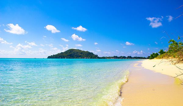 | ||
Selayar island bawean east java indonesia
Bawean Island (Indonesian: Pulau Bawean) is an island of Indonesia located approximately 150 km north of Surabaya in the Java Sea, off the coast of Java. It is administered by Gresik Regency of East Java province. It is approximately 15 km in diameter and is circumnavigated by a single narrow road. Bawean is dominated by an extinct volcano at its center that rises to 655 m above sea level. Its population as at the 2010 Census is about 70,000 people, but more than 26,000 of them (that is about 70% of the male population) were temporarily living outside, working in other parts of Indonesia, Singapore and Malaysia). As a result, females constituted about 77% of the actual population of the island, which is thus often referred to as the Island of Women (Indonesian: Pulau Putri).
Contents
- Selayar island bawean east java indonesia
- Map of Bawean East Java Indonesia
- The incredible journey in bawean island gresik
- Etymology
- Precolonial period
- Colonial period
- World War II and after
- Geography and climate
- Geology
- Flora and fauna
- Administration
- Economy and social activities
- Tourism and attractions
- Bawean Airport
- Demographics
- Language and religion
- Lifestyle
- References
Map of Bawean, East Java, Indonesia
The island territory is divided into two administrative districts, Sangkapura and Tambak. More than half the population (about 45,750) lives in the district of Sangkapura, centred on the town of that name located on the southern coast of the island. The island has rich nature with many endemic species, such as Bawean deer which is only found on the island and is included to the IUCN Red List. There are several large underwater petroleum and gas fields around the island.
The incredible journey in bawean island gresik
Etymology
The island's name is believed to originate from the Kawi (or Sanskrit) phrase ba (light) we (the sun) an (is) - thus: "having the sunlight". According to the legend, Javanese sailors wandering in the mist in 1350 named the island because they saw a glimpse of light around it; previously the island bore the Arabic name of Majidi.
During the Dutch colonization in the 18th to the 20th centuries, the island was renamed Lubok, but the locals and even the Dutch continued to use the name Bawean. The Dutch name fell out of use in the 1940s.
As a linguistic variation, the island is also called Boyan and its natives Boyanese. These names are also common in Malaysia and Singapore, being brought there by numerous visitors from Bawean. Another popular appellation is the island of women (Indonesian: Pulau Putri). This originates from the predominance of the actual female population, as since the 19th century most males have taken part-time jobs outside Bawean. So whereas the nominal female population percentage amounted to about 52% in 2009, the actual fraction (corrected for residents abroad) approximated 77%. This imbalance has become the subject of national and international studies.
Precolonial period
It is uncertain when humans first settled on Bawean. In the early Middle Ages ships sailing across the Java Sea often used the harbor on the island. The first records of permanent settlements on the island date to the 15th century. Most of the references to Bawean in regional (mostly Javanese) sources of the 16–17th centuries are associated with visits to the island of Muslim preachers. Mass conversion of islanders to Islam began after the death in 1601 of the local Raja Bebileono who favored animism and the arrival from Java of the Muslim theologian Sheik Maulana Umar Mas'ud. His dynasty became independent from the Javanese States, and his great-great-grandson Purbonegoro, who ruled the island between 1720 and 1747 visited Java as a sovereign ruler. The graves of Maulana and Purbonegoro are revered on the island, they are visited by Muslim pilgrims from other parts of Indonesia and are the main historical attractions of Bawean.
Colonial period
Dutch sailors first visited Bawean during their trading expedition to Java led by the explorer Cornelis de Houtman – on 11 January 1597, the expedition ship Amsterdam was badly damaged off the Bawean coast. In the 17–18th centuries, the island was regularly visited by ships of the Dutch East India Company, which was strengthening its position in this part of the Malayan archipelago, and in 1743 officially came under its control. The Island had little economic value and was used as a resting stop for ships sailing between Java and Borneo.
After the bankruptcy and liquidation of the East India Company in 1798, Bawean and all its other possessions came under the direct control of the Netherlands Crown. Whereas the island was governed by an appointed Dutch official, native nobility retained certain influence, and the Muslim institutions of justice settled local court matters. The Bawean religious court (Indonesian: Pengadilan Agama Bawean) was established in 1882.
Since the end of 19th century, men of the island began to regularly travel to work in the British colonial possessions in the Malay Peninsula, especially in Singapore. The Dutch authorities do not interfere with the activities of foreign recruiters who visited the island, as Bawean, with about 30,000 people and 66 settlements was overpopulated. The island was then producing tobacco, Indigo, cotton fabrics and coal, and exported the Bawean deer and local breed of horse. Large-scale planting of teak started in the 1930s and resulted in deforestation of most of the island.
World War II and after
During World War II large-scale battles between the Japanese and Allied Navies occurred in the vicinity of Bawean island, especially during the Dutch East Indies campaign of 1941–1942. On 25 February 1942, the island was captured by the Japanese troopers. On 28 February, in the first Battle of the Java Sea, the Japanese sunk several Allied ships, killing the commander of the East Indies Fleet, Rear Admiral Karel Doorman, on the light cruiser De Ruyter. The Second Battle of the Java Sea, also known as The Battle off Bawean, was fought on 1 March 1942. It resulted in sinking of all the participating Allied ships, including the heavy cruiser HMS Exeter and effective termination of the Anglo-Dutch resistance in the region. In August 1945, the Japanese garrison on the island surrendered to the Anglo-Dutch forces.
After the proclamation of the independent Republic of Indonesia on 17 August 1945 the island formally became a part of the new state. However, it remained de facto under Dutch control, and in February 1948, together with Madura and several other islands, was included in the quasi-independent state Madura promoted by the Government of the Netherlands. It joined the Republic of the United States of Indonesia (Indonesian: Republik Indonesia Serikat) in December 1949, and finally the Republic of Indonesia in March 1950.
Geography and climate
The island is located in the Java Sea about 150 km north of the larger island of Madura. It has a nearly round shape with the size varying between 11 and 18 km and the average value of 15 km. The shores are winding and contain many small bays; there are many small sandy islands (noko), rocks and coral reefs off the coast with the size up to 600 meters. The largest inhabited satellite islands are Selayar, Selayar Noko, Noko Gili, Gili Timur and Nusa.
Most of the island is hilly, except for the narrow coast and a plain in the southwestern part; it is therefore also called locally as "island of 99 hills". The highest point (655 m) is at the hill Indonesian: Gunung Tinggi (that literally means "high mountain"). The greatest heights are in the central and eastern parts of the island. Here are a few caldera lakes, the largest being the Lake Kastoba (Indonesian: Danau Kastoba). It has an area of about 0.3 km2, depth of 140 meters, and is located at an altitude of about 300 meters. There are several small rivers and waterfalls, the highest being Laccar and Patar Selamat, as well as hot springs such as Kebun Daya and Taubat.
The climate is tropical monsoonal, slightly less humid than the average in this part of Indonesia. Annual and daily temperature fluctuations are small, with the average maximum of 30 °C and the average minimum of 24.5 °C. Rainy season lasts from December to March, and the average monthly precipitation ranges from 402 mm in December to 23 mm in August. Northwesterly and easterly winds dominate the rainy and dry periods, respectively.
Geology
The island originated from a volcano located near its center. Igneous rocks make about 85% of its surface with occasional limestone, sandstone and dolomite. The soil in low-lying coastal areas is mainly alluvial, with a predominance of sand and gray clay. At altitudes of 10–30 meters above sea level, older alluvial accretions show up as horizontal layers of brown clay, and the higher areas are dominated by red-brown laterite.
The area is considered seismically active, with frequent tremors which are companied by landslides. The island has deposits of coal and onyx which are being mined from the early 2000s. There are oil and gas fields in the underwater shelf around the island, which are among the largest in Indonesia. Their development started in the 1960s and is being conducted now by the national company Pertamina and several foreign companies.
Flora and fauna
The fauna of Bawean Island is generally quite similar to that of Java. Initially, most of the island was covered by rainforest, but as a result of human activity its area gradually declined and by the end of the 20th century was not more than 10% of the island. About 15% is occupied by the artificially planted common teak (Tectona grandis).
The local jungles are characterized by dense low understory with a predominance of ferns, bryophytes and orchids. The most common tree species are Ficus, Nauclea and Symplocos adenophylla. Some plant species do not occur in the nearby Java Island, such as Canarium asperum, Pternandra coerulescens, Pternandra rostrata, Champera manilana, Ixora miquelii, Phanera lingua and Irvingia malayana. Mangrove bushes occur in some coastal areas of the island, with the main species being Sonneratia alba, Rhizophora mucronata, Bruguiera cylindrica and Lumnitzera racemosa.
The most notable representative of the fauna of the island is the endemic local subspecies of deer known as Bawean deer, Kuhl's hog deer or Bawean hog deer (Axis kuhlii). It is considered as a symbol of Bawean and is protected by Indonesian law. With less than 250 individuals, of which more than 90% belong to a single population, it is considered "critically endangered" and is included into the IUCN Red List.
Bawean hosts other rare mammals, such as crab-eating macaque (Macaca fascicularis), Sunda porcupine (Hystrix javanica), small Indian civet (Viverricula indica), Asian palm civet (Paradoxurus hermaphroditus). Most common birds are black-crowned night heron (Nycticorax nycticorax), purple heron (Ardea purpurea), great frigatebird (Fregata minor) and gull-billed tern (Gelochelidon nilotica). Reptiles are represented by different kinds of lizards (Varanus sp .), reticulated python (python reticulatus) and saltwater crocodile (Crocodylus porosus) which sometimes (rarely) swims to the island.
Nature conservation measures were being taken back when Bawean was under colonial administration of the Netherlands. In 1932, five forests with the total area of 4,556 hectares were declared natural reserves. In 1979, two national (Indonesian) nature reserves were created with areas of 3,832 and 725 ha, mostly to protect the forests and the habitat of the Bawean deer.
Administration
Bawean belongs to the province of East Java (Indonesian: Provinsi Jawa Timur). From 1975 it is a part of the Regency (kabupaten) of Gresik. The island is divided into two regions: Sangkapura and Tambak composed around the cities of the same names. Sangkapura has an area of 118.72 km2 and population of 48,280 (2009). It includes 17 villages is headed by M. Suhami. The area of Tambak is 77.55 km2 and population is 26,039 (2009). It contains 13 villages and is headed by B.S. Sofyan.
Economy and social activities
The main source of income for the majority of the Bawean population is money earned by relatives working abroad. The islanders are mainly engaged in growth of rice, maize, potato and coconuts. Yields are lower than in Java because of significantly lower levels of agricultural mechanization and more frequent droughts. Another common economical activities are fishing and growth of teak. The industry is represented by a few handicraft workshops. From 2006 onyx is being mined and in the central part of the island by several Taiwanese companies.
In 2009, the island had about 30 schools. Many young people go for their studies to Java and rarely return to the island. The island has several pharmacies and small clinics, but no hospital. Despite lack of equipment, local athletes are among the best in the county, especially in table tennis and a popular in Southeast Asia ball game sepak takraw (wherein a liana-woven ball is kicked over the net). Volleyball became popular in the 2000s with about 80 officially registered teams on the island.
The main ring road runs along the coast of the island; it has a length of about 55 km and 33 km of it are in poor condition. There are motorised vehicles, but most travel is done by bicycle, horse and cart, or becak. The main port of the island, Sangkapura, is connected with the settlements of northern coast of East Java and Madura. The busiest shipping route is Sangkapura – Gresik.
Tourism and attractions
Governments – both local and of Gresik – are attempting to appeal Bawean for tourists by advertising local natural attractions, which include the Lake Kastoba, hot springs Kebundaya and Taubat, waterfalls Lachchar and Patar Selamat, the caves in the central part of the island, sandy beaches and coral reefs on the coast. However, poor infrastructural development of the island, combined with its remoteness from Java, hinders the development of tourism here. In addition, some locals regard Kastoba as a sacred lake and protest visiting it by tourists.
Bawean Airport
In early 2013, Bawean Airport has 800 meters runway and at least two aviation companies have proposed fly to and from Bawean to the authority. The runway has been completely finished with 1,200 meters length and can accommodate 50 seaters airplanes. Due to the local authority is not ready to operate the airport, the local authority give the airport to the central government. It is predicted to operate in May 2015. Harun Thohir Airport was officially operated in January 2016.
Demographics
The high migration hinders accurate count of the number of people living on the island. In 2009, the number of residents was 74,319, of which at least 26,000 were living abroad – in Malaysia, Singapore and, to a lesser extent, in Java and other areas in Indonesia. The southern coast of the island is most densely populated with more than half of the islanders living in the city of Sangkapura.
Between about 1900 and 1930, the population was stable at the level of 30,000. It then rose, from 29,860 in 1930 to 59,525 in 1964, owing to the improving living conditions and arrival of new settlers from Madura. The growth rate then decreased and remains at 1% or higher per year.
Most people inhabiting the island in the 15–16th centuries were from Madura and, to a lesser extent, from Java islands. They were gradually mixed with traders, fishermen and pirates of Bugis and Malayan ethnicities coming from other parts of the Malay Archipelago. They were later joined by migrants from the Sumatran city of Palembang, who formed a community and took a dominant position in trade. By the beginning of the 20th century Baweans represented a fairly homogeneous ethnic community, and while living abroad formed compact communities and identified themselves as Baweans rather than other Indonesian groups.
Recent migrations to the island are small and are mostly composed of Javanese people who have certain interests on the island. Several hundred Javanese live on the island of Gili Barat which is connected to Bawean with a dam. They are engaged in growing coconut palms (Cocos nucifera). Newcoming Javanese are distinguished from the old Javanese settlers who live in the village Dipongo and speak an old-Javanese dialect.
A small Chinese community has existed on the island since at least the late 19th century. It is increasing both by natural growth and via mixed marriages of Baweans and Singaporese.
Baweans, working abroad form compact communities, some of which are known for over 150 years. For example, there were at least 763 Baweans in Singapore in 1849, most of whom lived in the area known as Malay: Kampung Boyan (Bawean village). Later, districts with the same name appeared in several parts of Malaysia. The largest migrations from the island occurred in the later 1940s – early 1950s, during the formation of Indonesia as an independent state and the associated political instability and economic difficulties. So in 1950, there were 24,000 Baweans in Singapore alone. Most Baweans living abroad keep close ties with their relatives on the island, regularly visit them, and often return after several years of absence.
The migrations from the island are mostly caused by lack of jobs in a small densely populated island and low incomes. There are generations of recruitment agents in Singapore and Malaysia specializing on employment of Baweans, mainly as construction workers and sailors. This migration also became a part of life, it is believed on the island that a man is not mature enough until he spends several years abroad. So a poll in the 2008–2009 revealed that only 55% of the locals justified the departure by economic reasons, while 35% associated it with the traditions or a desire to gain life experience.
Language and religion
Most population speaks a Bawean dialect, which is regarded as the most lexically and phonetically peculiar dialect of Madurese language; Baweans living in Singapore and Malaysia speak its slight variation called Indonesian: boyan selat. Virtually the entire population knows, to a various degree, the official language of the country – Indonesian. The predominant religion on the island is Sunni Islam, with some remnants of the traditional local beliefs.
Lifestyle
Traditional dwellings are quite similar on the Madura and Bawean islands. They have a bamboo frame, with porch, often on low poles. The roof is traditionally covered with palm leaves or reeds, but tile is becoming increasingly popular.
Local costume is closer to that of Java than Madura. Men wear sarong (a kind of kilt) and a long-skirted tunic, and women are dressed in sarong and a shorter jacket. There are Malayan and Bugis varieties of dress. The Malayan influence is more noticeable in the customs, ceremonies and folk dances, where the Madura heritage is weak. Also absent on the island are such traditional Madura elements as bull races and sickle-shaped knives.
The local cuisine is diverse and borrows from all local ethnicities. The traditional local pie stuffed with vegetables (usually potatoes) is popular in Indonesia, Malaysia and Singapore under the name Indonesian: roti Boyan (Bawean bread).