
Intercommunality Barrès-Coiron Area 17.39 km² Population 1,010 (2006) | Time zone CET (UTC+1) Local time Tuesday 5:25 PM | |
 | ||
Weather 8°C, Wind S at 3 km/h, 74% Humidity | ||
Baix is a French commune in the Ardèche department in the Auvergne-Rhône-Alpes region of southern France.
Contents
- Map of 07210 Baix France
- Geography
- History
- Administration
- Demography
- Civil heritage
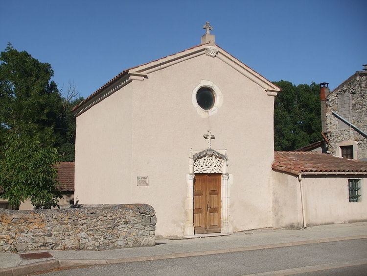
- Religious heritage
- References
Map of 07210 Baix, France
The inhabitants of the commune are known as Baixois or Baixoises.
Geography
Baix is located some 30 km south by south-west of Valence and 25 km north-east of Aubenas. Access to the commune is by the D86 road from Le Pouzin in the north which passes through the commune and the town and continues south to Cruas. The D22 branches off the D86 just inside the northern border of the commune and goes west to Chomérac. The commune is mostly forested but with farmland in the north-western third of the commune.
The Rhône river forms the eastern border of the commune and the department as it flows south however there is no crossing point in the commune. The nearest crossing point is at Le Pouzin 5 km north. Numerous streams rise in the commune and flow east to the Rhone including La Payre, the Ravin de Roux, the Ravin de Saint-Pierre, the Ruisseau de Notre-Dame, the Ravin de Besset, the Ruisseau de Cournairet, the Ruisseau de Sainte-Euphémie, with the Ruisseau de Sichier forming the southern border of the commune.
History
The banks of the Rhone at Baix have been occupied since Roman times.
Many islands existed at the level of the plain of the Payre river which allowed for fords across the Rhone.
There was a Greco-Roman town between Le Pouzin and Baix which was at the junction between the Antoninus Pius Roman way on the right bank of the Rhône and the Via Agrippa on the left bank. It is possible that Hannibal, advancing out of Spain, crossed the Rhône at this place with his elephants in about 218 BC before crossing the Alps.
The name of this town was Batiana meaning "easy passage", a name probably given by a Phoenician colony to indicate the ease that of crossing the Rhone in this place (batos = easy or feasible with ana = crossing) thanks to number of islands in the river at this point.
Batiana had a ferry to cross the Rhône and a horse relay.
The town lay on both banks of the river and perhaps also in the islands. As an obligatory place of passage, Batiana had to endure numerous invasions and destruction. It survived until the invasion of the Vandals in 411. The population of Batiana escaped the massacre and returned after an unknown time to rebuild the town on the ruins left by the Vandals. This new town was destroyed again in 735 by the Saracens who ravaged the entire Rhône Valley to Lyon at that time.
A new Batiana emerged from the ruins. The new population of Latin origin were not the same people as the former Phoenician population who abandoned their former homes and settled north of the Ouvèze at Le Pouzin leaving the Greek people in the south on the right bank of the Rhône at Baix.
The town was sheltered behind fortifications. To the south Baios (Baix) was created and Pusillus (Le Pouzin) to the north. Baios was first called Bacium, then Bacxus, Bays sur Bays, then finally Baix.
The remains of buildings and several ceramic tile graves have been uncovered around the Chapel of Saint Euphémie.
Administration
List of Successive Mayors
(Not all data is known)
Demography
In 2010 the commune had 1,034 inhabitants. The evolution of the number of inhabitants is known from the population censuses conducted in the commune since 1793. From the 21st century, a census of communes with fewer than 10,000 inhabitants is held every five years, unlike larger communes that have a sample survey every year.
Sources : Ldh/EHESS/Cassini until 1962, INSEE database from 1968 (population without double counting and municipal population from 2006)
Civil heritage
The commune has several buildings and sites that are registered as historical monuments: