
Canton Seurre Population (2010) 129 Local time Tuesday 11:45 AM | Area 12.57 km² | |
 | ||
Region Bourgogne-Franche-Comté Weather 7°C, Wind S at 24 km/h, 87% Humidity | ||
Bagnot is a French commune in the Côte-d'Or department in the Bourgogne-Franche-Comté region of eastern France.
Contents
- Map of 21700 Bagnot France
- Geography
- Administration
- Demography
- Civil heritage
- Religious heritage
- References
Map of 21700 Bagnot, France
The inhabitants of the commune are known as Bagnotins or Bagnotines.
Geography
Bagnot is located some 30 km south of Dijon and 15 km east by north-east of Beaune. Access to the commune is by the D20 from Argilly in the west which passes through the village and continues east to Auvillars-sur-Saône. The D35E goes south from the village to the D973. The A36 autoroute passes through the south of the commune from west to east but has no exit in the commune. The nearest exit is Exit 1 some 5 km east of the commune. The commune is extensively forested in the south with forests also in the north-west; the centre of the commune is farmland.
The Sereine river flows through the commune and the village from the north-east and continues south-west to join the Meuzin near Palleau. Two tributaries feed the Sereine from the commune - one fed by the Étang de Menans just west of the commune and the other from the Grand Étang west of the village. Another stream rises in the east of the commune and flows east through the Étang Limonet and Étang du Moulin, both just east of the commune, to the Saône river at Glanon.
Administration
List of Successive Mayors
(Not all data is known)
Demography
In 2010 the commune had 129 inhabitants. The evolution of the number of inhabitants is known from the population censuses conducted in the commune since 1793. From the 21st century, a census of communes with fewer than 10,000 inhabitants is held every five years, unlike larger communes that have a sample survey every year.
Sources : Ldh/EHESS/Cassini until 1962, INSEE database from 1968 (population without double counting and municipal population from 2006)
Civil heritage
The commune has a number of buildings and structures that are registered as historical monuments:
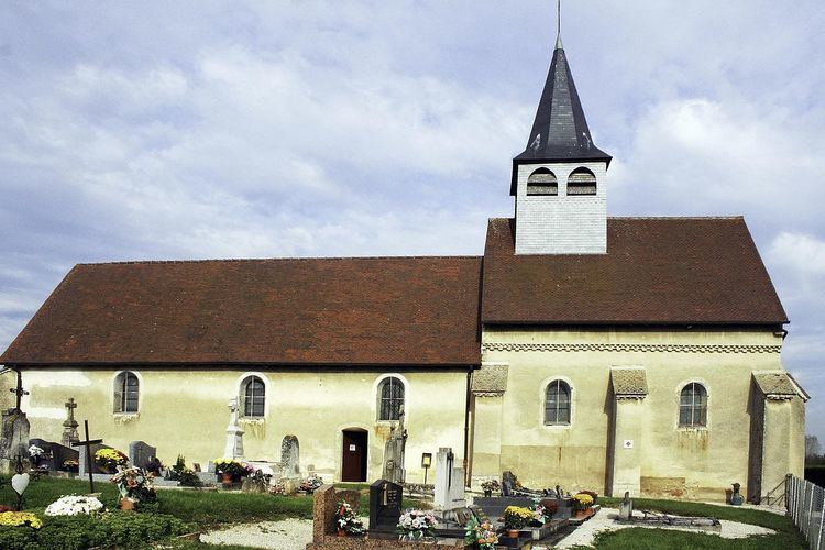
Religious heritage
The commune has several religious buildings and sites that are registered as historical monuments: