
 | ||
Dubai view hotel bagnotar best place for comfort and rest abbottabad pakistan
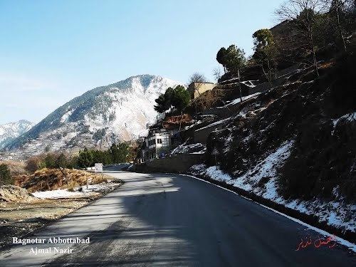
Bagnotar is one of the 51 union councils of Abbottabad District in Khyber-Pakhtunkhwa province of Pakistan. Bagnator is situated on the Abbottabad-Nathi Gali Road some 20 kilometres away from Abbottabad.
Contents
- Dubai view hotel bagnotar best place for comfort and rest abbottabad pakistan
- Map of Bagnoter Pakistan
- Location
- Earthquake 2005
- References
Map of Bagnoter, Pakistan
Location
Union council Bagnotar is situated in central part of District Abbottabad in Abbottabad Tehsil, and lies to south east of Abbottabad city – the capital city of the district. The area is included in the Lower Galliyat Belt. The main tribes of Bagnotar are the Jadoon and Karlal. However, other small ethnic groups are also settled in the area. Bagnotar is bounded by the following union councils, to the north by Sarbhana, and Beerangali, to the east Nagri Bala & Nathiagali, and to the south by Namli Maira and Phalkot, and to the west by Bagh.
Bagnotar town has an elevation of 1775 metres, and is located approximately 16 km from Abbottabad on Abbottabad-Murree Road. A lush green pine valley stretched on 810 square kilometers.The major landscape as well as the settlement of Bagnotar is located along the Barrian-Nathigali-Abbottabad Road (Abbottabad Murree Road), the 11 kilometers of which passes through the land of Bagnotar.
Earthquake 2005
On 8 October 2005 various parts of Abbottabad District were affected by the massive earthquake, although unlike neighbouring Kashmir the loss in human life was relatively low in this area, the death toll was recorded as 511, with 622 injured. Although the impact on infrastructure was still severe.