
Time zone Sri Lanka (UTC+05:30) Area 2,861 km² Population 886,000 (2011) | Largest City Badulla Website ds.gov.lk/dist_badulla Local time Tuesday 1:06 PM | |
 | ||
Divisions ListDivisional Secretariats:Grama Niladhari: Weather 24°C, Wind NE at 11 km/h, 94% Humidity | ||
badulla district ella ella jungle resort
Badulla (Sinhalese: බදුල්ල දිස්ත්රික්කය badūlla distrikkaya; Tamil: பதுளை மாவட்டம் Patuḷai māvaṭṭam) is a district in Uva Province, Sri Lanka. The entire land area of the Badulla district is 2,861 km² and total population is 837,000. The district is bounded by the districts of Monaragala and Rathnapura on the East & South, by Ampara and Kandy districts on the North and by Nuwara Eliya and Matale on the West. Mainly the economy of the district is based on agricultural farming and livestock.
Contents
- badulla district ella ella jungle resort
- Map of Badulla Sri Lanka
- Education
- Electorate Divisions in Badulla District
- Major Cities
- Big Towns
- Other Towns
- Demography
- Important Locations in Badulla District
- Maps
- References
Map of Badulla, Sri Lanka
Badulla District is an agricultural district where tea, vegetable and paddy are cultivated. Mainly the district is divided into two portions as Upper region and Lower region according to climatic and geographical characteristics. Upper division of the district is famous for tea plantation and vegetable cultivation while lower division is famous for paddy cultivation.
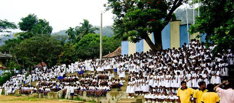
Education
S.Thomas' College Bandarawela, Bandarawela Central College, Dharmadutha College, UVA College, Badulla Central College, Vishaka Girls High School, Viharamahadevi Girls School, Passara National College, Passara Tamil National College, Sri Ramakrishna College, Al Adhan Maha Vidyalaya, Barathy Maha Vidyalayam, Tamils Girls Convent and Saraswathy Central College are situated in this district.
Electorate Divisions in Badulla District
Major Cities
Big Towns
Other Towns
Demography
(2010 estimates 887220)