
Local time Thursday 3:50 PM | ||
 | ||
Time zone Sri Lanka Standard Time Zone (UTC+5:30) Weather 19°C, Wind NE at 6 km/h, 92% Humidity | ||
Haputale to liptons seat
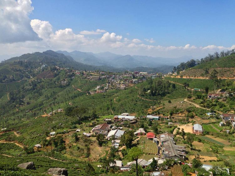
Haputale (හපුතලේ in Sinhala Language) is a town of Badulla District in the Uva Province, Sri Lanka, governed by an Urban Council. The elevation is 1431 m (4695 ft) above the sea level. The area has a rich bio-diversity dense with numerous varieties of flora and fauna. Haputale is surrounded by hills covered with cloud forests and tea plantations. The town has a cooler climate than its surroundings, due to its elevation. The Haputale pass allows views across the Southern plains of Sri Lanka. The South-West boundary of Uva basin is marked by the Haputale mountain ridges, which continue on to Horton Plains and Adam's Peak to the west. CNN in 2010 named Haputale as one of Asia's most overlooked destinations.
Contents
- Haputale to liptons seat
- Map of Haputale Sri Lanka
- The untrodden paths of haputale
- Transport
- Population
- Maps
- Places of interest
- Adisham Bungalow
- Liptons Seat
- Weather
- Members of Parliament
- References
Map of Haputale, Sri Lanka
Notable Government institutions are :
The untrodden paths of haputale
Transport
Population
Source
Maps
Places of interest
Adisham Bungalow
Adisham Bungalow is a nineteenth-century British period building, which was modelled on Leeds Castle in Kent, England. Sir Thomas Villiers, a distinguished British resident in Sri Lanka in the early 20th century, used it as his country house. Later it became a Benedictine monastery. The Thangamale Bird Sanctuary is located next to the bungalow.
Lipton’s Seat
The Lipton’s Seat is located at Dambetenna in the Haputale Mountain region. This place was a favourite look-outpoint for Sir Thomas Lipton. The point has a fabulous view over Uva, Southern, Sabaragamuwa, Central and Eastern provinces.
Weather
Members of Parliament
The constituency has been represented in Parliament by: