
 | ||
Time zone Sri Lanka Standard Time Zone (UTC+5:30) | ||
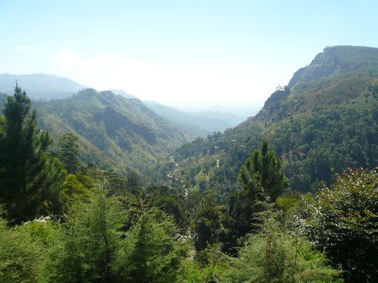
Ella (Sinhalese: ඇල්ල; Lit. "water fall"; Tamil: எல்ல) is a small town in the Badulla District of Uva Province, Sri Lanka governed by an Urban Council. It is approximately 200 kilometres (120 mi) east of Colombo and is situated at an elevation of 1,041 metres (3,415 ft) above sea level. The area has a rich bio-diversity, dense with numerous varieties of flora and fauna. Ella is surrounded by hills covered with cloud forests and tea plantations. The town has a cooler climate than surrounding lowlands, due to its elevation. The Ella Gap allows views across the southern plains of Sri Lanka.
Contents
Map of Ella, Sri Lanka
Road
Located on the Colombo-Badulla railway line, and the A16 highway (Beragala-Hali Ela) a part of the Colombo-Badulla road.
Rail
Ella railway station is the 75th station on the Main Line and is located 271.03 km (168.41 mi) from Colombo. The station has one platform and all trains running on the Main Line stop at the station. The station opened in July 1918.
Facilities
Notable Government institutions are :