
Local time Wednesday 9:53 AM | ||
 | ||
Time zone Sri Lanka Standard Time Zone (UTC+05:30) Weather 24°C, Wind E at 8 km/h, 79% Humidity | ||
Sri lanka ceylon lunugala
Lunugala is a town in the Sri Lankan province of Uva.There are 26 Grama Niladhari Divisions in the Lunugala Divisional Secretariat Division
Contents
- Sri lanka ceylon lunugala
- Map of Lunugala Sri Lanka
- Society Population Distribution
- Schools
- Religious places
- Hospitals
- Public banks
- References
Map of Lunugala, Sri Lanka
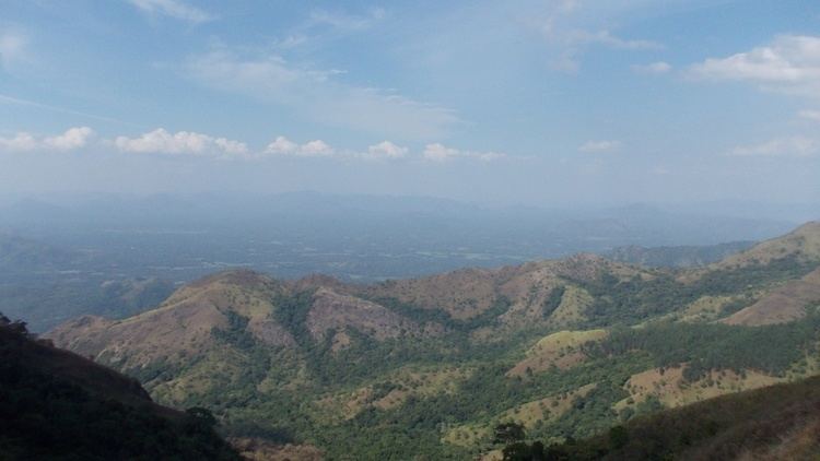
The town is placed in middle of a mountain range. It was called "Pattipola" (පට්ටිපොල) in the past. Its main agricultural product is tea. There are many beautiful tea estates in Lunugala as Adawatta Estate, Park Estate, Hopton Estate, Showlands Estate and Madolsima Plantation. Additionally people cultivate pepper, cinnamon and cacao.
Society & Population Distribution
Basically the society of lunugala consists of three major types—Sinhala, Tamil and Muslims. These people live peacefully together. In some places there are cross marriages as Tamil-Muslims, Muslim-Sinhala and Tamil-Sinhala.
Schools
Religious places
Hospitals
Public banks
References
Lunugala Wikipedia(Text) CC BY-SA