
OS grid reference TG120370 Sovereign state United Kingdom Local time Monday 10:06 PM | Civil parish Baconsthorpe CP Area 5.53 km² Dialling code 01263 | |
 | ||
Population 215 (parish, 2011 census) Weather 3°C, Wind SW at 29 km/h, 91% Humidity | ||
Baconsthorpe is a village and civil parish in the English county of Norfolk. It is 6 km south-east of Holt, 8 km south of Sheringham and 32 km north of Norwich.
Contents
Map of Baconsthorpe, UK
The civil parish has an area of 5.53 km² and in the 2001 census had a population of 232 in 105 households, the population reducing to 215 at the Census 2011. For the purposes of local government, the parish falls within the district of North Norfolk.
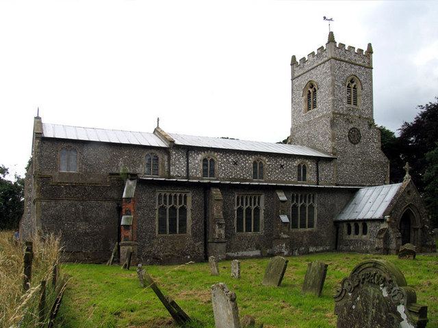
The ruins of the 15th-century Baconsthorpe Castle lie about one mile (1.6 km) to the north of the village. The medieval Anglican church of St Mary was restored in 1868 and 1958. It contains interesting monuments from the 15th–18th centuries and some 16th-century glass saved from the castle.
Notable residents
References
Baconsthorpe Wikipedia(Text) CC BY-SA