
Population 8,093 (2006 census) Postcode(s) 4807 Local time Saturday 3:50 PM | Established 1882 Elevation 12.0 m (39 ft) Postal code 4807 | |
 | ||
Weather 28°C, Wind E at 21 km/h, 73% Humidity Points of interest Burdekin Bridge, Burdekin Dam, Plantation Park | ||
Ayr is a town and locality in the Shire of Burdekin, Queensland, Australia.
Contents
- Map of Ayr QLD 4807 Australia
- Geography
- History
- Heritage listings
- Education
- Health
- Transport
- Sport
- Media
- Amenities
- Notable people from Ayr
- References
Map of Ayr QLD 4807, Australia
Geography
Ayr is located 88 kilometres (55 mi) south of Townsville on the Bruce Highway and 12 kilometres (7.5 mi) away from the (smaller) town of Home Hill. It is 112 kilometres (70 mi) north of Bowen and 290 kilometres (180 mi) north of Mackay. Ayr is located near the delta of the Burdekin River. It is within the Burdekin Shire, which produces the most sugar cane per square kilometre in Australia utilising underground water supplies and water from the Burdekin Dam to irrigate crops when rains fail.
Alva beach, a popular area for fishing and swimming, is located 16 kilometres (9.9 mi) east of Ayr.
Ayr has a population of approximately 8,000.
History
Ayr is believed to be named after the Scottish town of Ayr, the birthplace of Queensland Premier Sir Thomas McIlwraith.
Ayr Post Office opened on 25 August 1883.
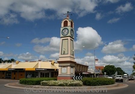
The Ayr War Memorial Arch is the entrance to the Memorial Park and commemorates those who served in World War I. It was dedicated in November 1925 by the shire chairman, Councillor Barsby.
Heritage listings
Ayr has a number of heritage-listed sites, including:
Education
Ayr has several state primary schools (Ayr, East Ayr, Kalamia and several others in surrounding areas) and two non-government primary schools, St Francis School (Catholic) and Burdekin Christian College. Ayr has one state high school and one non-government high school. Ayr State High School was the 8th public secondary high school in Queensland. The non-government high school is called the Burdekin Catholic High School.
Health
Ayr is home to a small, state owned hospital. The one-storey building offers basic emergency care. The hospital features a helipad, which is utilized during more serious emergencies.
Transport
The A1 passes through the town. This, mostly two laned highway, is the major road of the Burdekin. It links Ayr with neighboring Brandon and Home Hill. Ayr's main street, Queen street, is a wide two laned street capable of handling a large amount of slow travelling cars.
Ayr Railway Station is the town's rail transit stop. Regular services run from Brisbane to Cairns.
While the town has no public transport, several bus routes pick up school children across the region.
Sport
A wide variety of sports are played in Ayr, including Touch football, Rugby League, Rugby Union, Soccer, tennis and golf. Netball and Table Tennis (ping pong) are also popular. The Ayr Surf Life Saving club is a small yet highly established club.
Media
Ayr is home to one newspaper. The Ayr Advocate has a Burdekin-wide circulation of just under 4000 people. The paper is published by Sydney-based News Corporation, and has three full-time journalists.
The town is home to the centre-right satirical publication The Burdekin Herald which was launched in 2013. In January 2014 the Burdekin Herald published an article claiming that the conservative Queensland government was going to introduce 22 000 poisonous snakes into homes to rid the state of cane toads.
Amenities
Ayr has the usual chain stores, ten pin bowling, a toyshop, cinema, six pubs, and a range of sports, electrical and fashion stores. Ayr has several banks including the Commonwealth, ANZ, Suncorp, National and Bendigo Bank. Ayr also has a Domino's Pizza located at 118 Edwards street.