
Population 18,531 (2010) Area 5,052 km² Mayor Lyn McLaughlin | Established 1888 Founded 1888 | |
 | ||
Points of interest Great Barrier Reef, Great Barrier Reef Mari, Burdekin Bridge, Burdekin Dam | ||
The Shire of Burdekin is a local government area located in North Queensland, Australia in the Dry Tropics region. The district is located between Townsville and Bowen in the delta of the Burdekin River.
Contents
Map of Burdekin, QLD, Australia
It covers an area of 5,052.5 square kilometres (1,950.8 sq mi), and has existed as a local government entity since 1888.
History
On 16 January 1888, the Ayr Division was created out of Subdivision 3 of the Thuringowa Division in 1888 under the Divisional Boards Act 1887.
With the passage of the Local Authorities Act 1902, Ayr Division became the Shire of Ayr on 31 March 1903.
On 12 June 1982, the Shire of Ayr was renamed the Shire of Burdekin, a change long desired by the residents of Home Hill.
Council members were elected to represent different divisions within the shire until the election of March 1994 at which all council members are elected by all shire residents. The title of Mayor replaced the former title of Shire Chairman and the title of Shire Clerk was replaced by Chief Executive Officer from that same election.
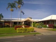
New shire chambers were opened on 9 October 1999. The cost was $2.8 million.
From 2000, council elections were held every four years to elect a mayor and ten councillors. From 2008, this was reduced to a mayor and six councillors.
Towns and localities
The Shire of Burdekin includes the following settlements: