
Area 7.86 km² | Canton Garlin Time zone CET (UTC+1) Population 147 (2006) | |
 | ||
Aydie is a French commune in the Pyrénées-Atlantiques department in the Nouvelle-Aquitaine region of south-western France.
Contents
- Map of 64330 Aydie France
- Geography
- Toponymy
- History
- Administration
- Inter communality
- Demography
- Economy
- Civil heritage
- Religious heritage
- Notable people linked to the commune
- References
Map of 64330 Aydie, France
Geography
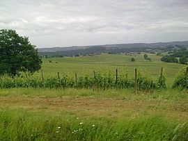
Aydie is located some 40 km north-east of Pau and 15 km east of Garlin. The northern border of the commune is the departmental border between Pyrénées-Atlantiques and Gers and the eastern border is the border with Hautes-Pyrénées. Access to the commune is by the D292 road from Aubous to Arrosès which passes south through the west of the commune. The D317 branches off the D205 west of the commune and goes east through the commune to the village then continues east, changing to the D548 at the border, to join the D48. The commune is mainly farmland with scattered forests in the west.
The Sager river forms the eastern border of the commune as it flows north to join the Adour at Saint-Mont. Several streams rise in the west of the commune and flow east to join the Sager including the Boutigué which forms part of the northern border of the commune.
Toponymy
The commune name in béarnais is Aidia. Michel Grosclaude said that the name probably has a common root with Aydius but the origin and meaning of the name remains obscure.
The following table details the origins of the commune name and other names in the commune.
Sources:
Origins:
History
Paul Raymond noted on page 18 of his 1863 dictionary that in 1395 Aydie had 25 fires and Poey (Page 136) had 6 fires with both of them under the bailiwick of Lembeye.
Administration
List of Successive Mayors
(Not all data is known)
Inter-communality
The commune is part of five inter-communal structures:
Demography
In 2010 the commune had 140 inhabitants. The evolution of the number of inhabitants is known from the population censuses conducted in the commune since 1793. From the 21st century, a census of communes with fewer than 10,000 inhabitants is held every five years, unlike larger communes that have a sample survey every year.
Sources : Ldh/EHESS/Cassini until 1962, INSEE database from 1968 (population without double counting and municipal population from 2006)
Economy
The commune is part of the appellation d'origine contrôlée (AOC) zones of Madiran (Red Madiran wine), Pacherenc-du-vic-bilh (White Madiran wine), and Béarn.
Civil heritage
The commune has many sites that are registered as historical monuments:
Religious heritage
The commune has three religious sites that are registered as historical monuments: