
Length 220 km | ||
 | ||
Bridges Atchafalaya Basin Bridge, Long–Allen Bridge, Krotz Springs Bridge, E. J. "Lionel" Grizzaffi Bridge, Berwick Bay Bridge Sources Mississippi River, Red River of the South | ||
Atchafalaya river basin swamp tour 3
The Atchafalaya River /ətʃæfəˈlaɪ.ə/ is a 137-mile-long (220 km) distributary of the Mississippi River and Red River in south central Louisiana in the United States. It flows south, just west of the Mississippi River, and is the fifth largest river in North America, by discharge. The name "Atchafalaya" comes from Choctaw for "long river", from hachcha, "river", and falaya, "long".
Contents
- Atchafalaya river basin swamp tour 3
- Map of Atchafalaya River Louisiana USA
- Atchafalaya river bridge passage
- Atchafalaya BasinEdit
- Old river control structureEdit
- Atchafalaya National Heritage AreaEdit
- References
Map of Atchafalaya River, Louisiana, USA
Atchafalaya river bridge passage
Atchafalaya BasinEdit
The Atchafalaya River is navigable and provides a significant industrial shipping channel for the state of Louisiana, as well as the cultural heart of the Cajun Country. The maintenance of the river as a navigable channel of the Mississippi River has been a significant project of the U.S. Army Corps of Engineers for over a century. Natural development of the river channel, coupled with channel training and maintenance for flood control and navigation, have combined to isolate the river from the swamp. The river valley forms the Atchafalaya Basin and Atchafalaya Swamp located in southern Louisiana near the Gulf of Mexico.
The Atchafalaya became a main distributary of the Mississippi in 1839 to 1849 when locals removed a huge log jam (the Great Raft) that was obstructing the Atchafalaya River.
Old river control structureEdit
The river is formed near Simmesport at the confluence of the Red River with the Mississippi, where the Mississippi connects to the Red River by the 7-mile-long (11 km) canalized Old River (part of the Old River Control Structure). It receives the water of the Red as well as roughly 30% of the water of the lower Mississippi (the other 70% continues in its main channel to the southeast). The volume the Atchafalaya receives from the Mississippi is controlled by the Old River Control Structure, a system of a low-sill structure, an auxiliary structure, an overbank structure, a navigation lock, and a power plant near Red River Landing, Louisiana, and in times of extreme flooding the Morganza Spillway further downstream.
During the 2011 Mississippi River floods, the Old River complex was discharging over 706,000 cubic feet per second (20,000 m3/s) into the Atchafalaya River, and the Morganza Floodway was discharging one-fourth of its capacity. If the Mississippi were allowed to flow freely, the Atchafalaya would capture the main flow of the Mississippi, permitting the Mississippi to bypass its current path through Baton Rouge and New Orleans. Despite control efforts, some researchers believe the likelihood of this event increases each year due to natural forces inherent to river deltas.
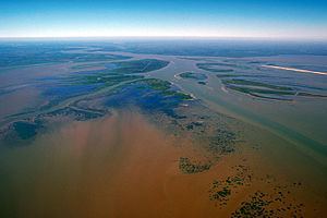
The Atchafalaya River meanders south as a channel of the Mississippi, through extensive levees and floodways, past Morgan City, and empties into the Gulf in Atchafalaya Bay approximately 15 miles (24 km) south of Morgan City. The river is now forming a new delta in the bay, the only place on the Louisiana coastline that is gaining ground.
In 1942 part of the flow of the Atchafalaya River was diverted through Wax Lake to the sea further west.
Atchafalaya National Heritage AreaEdit
The river's valley was designated Atchafalaya National Heritage Area in 2006.