
Intercommunality Vallée de Barétous Area 92.23 km² | Time zone CET (UTC+1) Population 1,092 (2006) | |
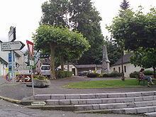 | ||
Arette (Areta in Occitan) is a French commune in the Pyrénées-Atlantiques department in the Nouvelle-Aquitaine region of southwestern France. It is located in the arrondissement of Oloron-Sainte-Marie and is one of the six communes of the canton of Aramits: the other five being Ance, Aramits (commune), Féas, Issor, and Lanne-en-Barétous.
Contents
- Map of Arette France
- Geography
- Hydrography
- Toponymy
- History
- Administration
- Inter communality
- Twinning
- Demography
- Distribution of Age Groups
- Economy
- Civil heritage
- Religious heritage
- Environmental heritage
- Education
- Sports and sports facilities
- Notable people linked to the commune
- References
Map of Arette, France
Geography
Arrete is located some 15 km south by south-west of Oloron-Sainte-Marie and some 4 km south-east of Aramits. It lies close to both the French Basque region and borders Spain in the south. It is within the borders of Béarn, one of the traditional French provinces.
Access to the commune is by French rail SNCF to Pau, and a short bus ride to Arrete. Less scenic is the automobile route: D918 road from Lanne-en-Barétous in the north-west coming south-east to the village then continuing east to Issor. The D132 goes south from the village down the length of the commune following a tortuous mountain route before exiting the southern border of the commune over the Col de la Pierre St Martin (1,760m), which is also the border with Spain, and becoming the Spanish NA-137 which continues to Isaba. The D341 also goes south-east from the village then south, connecting with the D241 at the Col de Labays (1,351m) going east to join the E7 highway south of Sarrance, then continuing along the south-western border to join the D441 south of the commune. The D133 also goes north from the village to Aramits.
Bus Route 848 of the Intercity Network of Pyrénées-Atlantiques (Transports 64) links Arette to Oloron-Sainte-Marie.
Arette is a very large commune and has a land area of 92 km2. It is also mountainous (the La Pierre Saint-Martin ski resort is within its borders, for example) and its highest peak is the 2,315 m Soum Couy, which is situated not far from the 2,504 m Pic d'Anie, the highest peak in the western Pyrenees. From Pic d'Anie the mountain range extends downwards for approximately 20 km, forming both sides of the Aspe Valley to the north-west. The Vert d'Arette (a tributary of the Vert) flows through this valley. The ancient village (also named Arette) from which the commune extends is located at an altitude of 316 m in the valley of Barétous, which lies between the aforementioned Aspe valley, to its east, and the Basque province of Soule, to its west.
Hydrography
Located in the Drainage basin of the Adour, the commune is the source of numerous tributaries of the Vert which is itself a tributary of Gave d'Oloron. The largest tributary flowing through the commune is the Vert d'Arrette however many other streams flow north towards the Vert including: the Abat Daurèye and its tributary, the Banu Erreka (accompanied by the Ruisseau de Aurèye); Ibarcis Erreka; the Lancy; the Ruisseau de Gurré and its tributary the Ruisseau de Lagaretche; the Ruisseau de Hournères and its tributary, the Ouettone; the Ruisseau de Légorre and its tributary, the Cassiau de Ber; the streams of Nécore, Soulayets, Talu Gros, and Virgou with the tributary of the latter, the Arrigau (accompanied itself in the commune by the Bachère).
The Gave de Lourdios, a tributary of the Gave d'Aspe, and its tributaries, the Arric and the Moulia (and their tributaries, Casteigt Erreka and the Ruisseau de Poussious) also pass through the commune. The Gave de Sainte-Engrâce, a tributary of the Saison, and its tributary, the Montcholako Erreka also flow in the territory of the commune.
Toponymy
The commune name in béarnais is Arèta (according to the classical norm of Occitan). The name comes from the Basque ar- meaning "stone" and from the locative suffix -eta meaning "stony place".
The following table details the origins of the commune name and other names in the commune.
Sources:
Origins:
History
In 1385 there were 87 fires in Arette and it depended on the Bailiwick of Oloron.
On 13 August 1967 the village of Arette was 80% destroyed by an earthquake that killed one person. The ruined clock tower of the church indicated the exact time of the earthquake: 11:10 p.m. Seismic waves were felt from Pau to Tarbes and Bayonne.
Administration
List of Successive Mayors
(Not all data is known)
Inter-communality
Arette is part of six inter-communal structures:
Twinning
Arette has twinning associations with:
Demography
In 2009 the commune had 1,121 inhabitants. The evolution of the number of inhabitants is known from the population censuses conducted in the commune since 1793. From the 21st century, a census of communes with fewer than 10,000 inhabitants is held every five years, unlike larger towns that have a sample survey every year.
Sources : Ldh/EHESS/Cassini until 1962, INSEE database from 1968 (population without double counting and municipal population from 2006)
Distribution of Age Groups
The population of the town is relatively old. The ratio of persons above the age of 60 years (28.8%) is higher than the national average (21.6%) and the departmental average (25.9%). As with national and departmental allocations, the male population of the town is less than the female population (48.1% against 48.4% nationally and 48.2% at the departmental level).
Percentage Distribution of Age Groups in Arette and Pyrénées-Atlantiques Department in 2009
Sources:
Economy
The economy of the commune is primarily oriented toward agriculture and livestock (cattle and sheep) and logging. The town is part of the Appellation d'origine contrôlée (AOC) zone designation of Ossau-iraty.
Civil heritage
The Barétous Museum is located in the commune. It features permanent collections on pastoralism and the Junta Roncal or "Tribute of the Three Cows".
Religious heritage
The former Lay Abbey (17th century) is registered as an historical monument.
The Arette Church contains several items that are registered as historical objects:
Environmental heritage
There is an arboretum in the east of the commune.
Education
Arette has a public college: the College of Arette Barétous and a primary school.
Sports and sports facilities
The Basque pelota Club trains on the village fronton.
The town is located on the route of the 16th stage of the Tour de France 2007 which took place on 25 July. On Bastille Day 2015 the Tour will pass through the town again. 218 km route linked Orthez to Gourette - Col d'Aubisque.
The Hill-climbing event, organized since 1984, is listed as a championship of France.