
Traversed by D132/NA1370 | Elevation 1,766 m | |
 | ||
Similar Port de Larrau, Col de Marie‑Blanque, Pic d'Arlas, Col d'Aubisque, Col du Soulor | ||
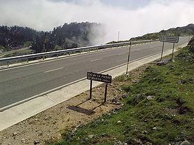
Col de la Pierre Saint-Martin (elevation 1,766 m (5,794 ft)) is a mountain pass on the France-Spain border in the western Pyrenees in the department of Pyrénées-Atlantiques (France) and Navarra (Spain). The climb from the Spanish side was used in the 2007 Tour de France.
Contents
Map of Col de la Pierre St Martin, Arette, France
Close to the summit of the pass, there is the ski station of Arette-Pierre-Saint-Martin.
In 2015, on Bastille Day, the tenth leg of the Tour climbed the Col in the other direction, from Arette up to the village of Pierre Saint Martin, which hosted the end of a stage for the first time ever. .
Details of the climb
The southern side of the climb, starting from Isaba (Navarra, Spain) is 27 km (17 mi) long at an average gradient of 3.6% (height gain – 966 m (3,169 ft)). The final stages of the climb start at Larra Belagua (1026m.) with 14 km (8.7 mi) at 5.2%, with a maximum of 7.4%.
The pass is situated south east of Oloron-Sainte-Marie. Starting from Arette (north east), the climb is 15.3 km (9.5 mi) long gaining 1,466 m (4,810 ft) (an average gradient of 5.7%). En route, the climb passes over the Col de Labays (1,351 m (4,432 ft)), the Pas de Guilhers (1,436 m (4,711 ft)) and the Col du Soudet (1,540 m (5,050 ft)).
Tour de France
The climb from the south featured in 2007 in the Tour de France for the first time on the 218.5 km (135.8 mi) stage 16 from Orthez to Gourette–Col d'Aubisque.