
Length 690 km | Source Mismi | |
 | ||
The Apurímac River (Spanish: Río Apurímac, [ˈri.o apuˈɾimak]; from Quechua apu 'divinity' and rimaq 'oracle, talker') rises from glacial meltwater of the ridge of the Mismi, a 5,597-metre-high (18,363 ft) mountain in the Arequipa Province in southern Peru.
Map of Apurimac River, Peru
The Apurímac is a source of the world's largest river system, the Amazon River. It rises in the south-western mountain ranges of Peru, 10 km (6.2 mi) from the village Caylloma, and less than 160 km (99 mi) from the Pacific coast.
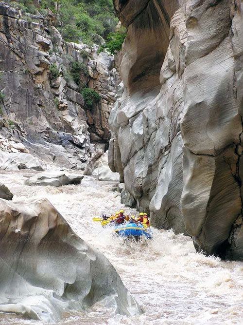
It flows generally northwest past Cusco in narrow gorges of up to 3,000 m, twice as deep as the Grand Canyon in the United States, its course interrupted by falls and rapids. Of the six attempts so far to travel the Apurímac in its full length, only two have been successful.
After 730.70 kilometres (454.04 mi), the Apurímac joins the Mantaro River and becomes the Ene River at 12°15′46″S 73°58′44″W, 440 m (1,440 ft) above sea level; then after joining the Perené River at 330 m (1,080 ft) above sea level, it becomes the Tambo River; when it joins the Urubamba at 280 m (920 ft) above sea level the river becomes the Ucayali, which is the main headstream of the Amazon.
Sometimes the complete river from its source to its junction with the Ucayali, i.e. including the rivers Ene and Tambo, is called "Apurímac", with a total length of 1,069.80 km (664.74 mi).
In the 13th century, the Inca constructed a bridge over this river which gave them access to the west. Erected around 1350, it was still in use in 1864, and dilapidated but still hanging in 1890. It was the basis for the titular bridge in Thornton Wilder's 1927 novel The Bridge of San Luis Rey.