
- elevation 400 m (1,312 ft) Length 159 km Country Peru | - elevation 287 m (942 ft) Source Perené River | |
 | ||
- location confluence with Urubamba River, Peru Mouths Ucayali River, Urubamba River | ||
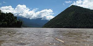
The Tambo River (Spanish: Río Tambo) is a Peruvian river on the eastern slopes of the Andes. The name only refers to a relatively short section; about 159 km (99 mi) long. It starts at the confluence of the Ene and Perené Rivers at the town of Puerto Prado. From here the Tambo River flows 70 km (43 mi) in an easterly direction and then turns north. When merging with the Urubamba River at the town of Atalaya, it becomes the Ucayali River.
Map of R%C3%ADo Tambo, Peru
The Tambo is part of the headwaters of the Amazon River whose origin is the Apúrimac River at Nevado Mismi.
References
Tambo River (Peru) Wikipedia(Text) CC BY-SA