
Prominence 2,886 ft (880 m) Topo map USGS Apache Peak | Elevation 2,350 m | |
 | ||
Similar Mount Glenn, Chiricahua Peak, Carr Peak, Miller Peak, Thimble Peak | ||
Apache Peak, at 7,714 feet (2,351 m), is the highest peak in the Whetstone Mountains in Cochise County, Arizona. The summit, located in the Coronado National Forest, is a popular local hiking destination. It is located near the Kartchner Caverns State Park, the city of Benson, Interstate 10, and Arizona State Route 90.
Contents
Map of Apache Peak, Arizona 85602, USA
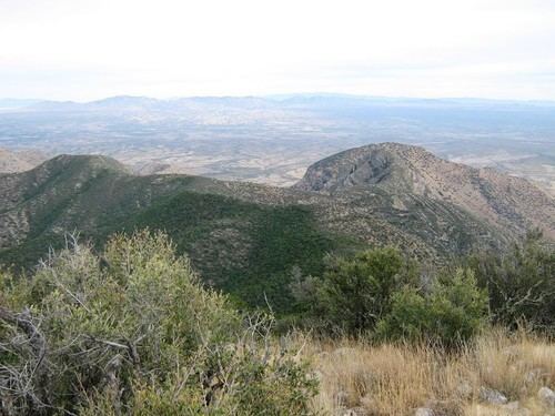
Hiking up Apache Peak
The summit of Apache Peak can be gained by a couple of different trails, which both involve moderately strenuous hikes with loose rocks, dense shrub, grass, cactus, succulents, and some small trees. Trails include the east side French Joe Canyon route and the west side Empire Ranch route.
Hiking requires approximately 4,160 feet (1,268 m) in elevation gain and ~12.6 miles distance round-trip. Those attempting to hike to the summit of Apache Peak should bring at bare minimum 3 liters of water, especially in the summer months. The humidity in winter is very low (< 15%) so bring more water than you expect even when the temperatures are not high. In winter snow storms are common. In summer fierce lightning storms and flash floods hit the peaks so do not hike in summer when thunderstorms are present.