
Named for Andrew Jackson Davis Website www.andrewcounty.org Founded 1841 Unemployment rate 4.3% (Apr 2015) | Area 1,129 km² Population 17,445 (2013) | |
 | ||
Andrew County is a county located in the northwestern part of the U.S. state of Missouri. As of the 2010 census, the county had a population of 17,291. Its county seat is Savannah. The county was organized January 29, 1841 and named for Andrew Jackson Davis, a lawyer and prominent citizen of St. Louis.
Contents
- Map of Andrew County MO USA
- History
- Geography
- Adjacent counties
- Major highways
- Demographics
- Public schools
- State
- Federal
- Missouri Presidential Preference Primary 2008
- Cities
- Villages
- Unincorporated communities
- Townships
- Notable natives
- References
Map of Andrew County, MO, USA
Andrew County is part of the St. Joseph, MO-KS Metropolitan Statistical Area, which is included in the Kansas City, Missouri, Kansas City metropolitan area.
History
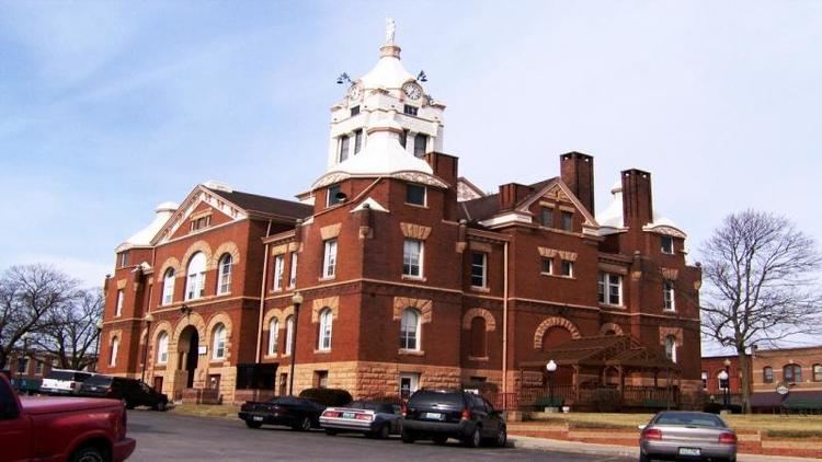
The following material is inscribed on a plaque erected by the State Historical Society of Missouri and State Highway Commission in 1960, now located by the Andrew County Courthouse.
Andrew County, organized 1841, is one of six counties in the Indian Platte Purchase Territory annexed to Missouri in 1837. Named for Andrew Jackson Davis, a St. Louis editor, the county was first settled in the middle 1830s. Pioneers were from Ohio, Indiana, Tennessee, Kentucky, Virginia, and other parts of Missouri.
Savannah, the county seat, was laid out in 1841. First briefly called Union, it was renamed for Savannah, Georgia. The Platte County Railroad (CB&Q) reached there in 1860, and today's Chicago, Great Western in the late 1880s. The town grew as a shipping point and trading center in the post Civil War era.
Divided during the Civil War, Andrew County sent troops to both sides. In August 1861, 1,500 soldiers from Andrew County and other counties joined the pro-Southern Missouri State Guard at Camp Highly in eastern Andrew County while others joined a large Union cap in adjacent Gentry County. In 1861, Union troops seized "Northwest Democrat," a pro-Southern newspaper, in Savannah and troops from Camp Highly seized the "Plain Dealer," a Union newspaper. Raiding guerrilla bands overran the county through 1863.
Andrew County's glacial plains support fertile livestock, grain, and fruit farms. The One Hundred and Two River, along with the Platte River, are located in the county. Its western border is formed by the Nodaway and Missouri rivers. In 1804 the Lewis and Clark Expedition camped on an island at the mouth of the Nodaway River. Members of fur trader W. Price Hunt's 1811 Astorian expedition wintered near the river’s mouth as well.
Among the towns located in Andrew County are Amazonia, once on the Missouri River, now inland, laid out in 1857 near the site of Nodaway City, an early river port; Fillmore, established in 1845; Whitesville, established in 1848; Rochester, established in 1848; Bolckow, established in 1868; Rosendale, established in 1869; Rea, established in 1877; Helena, established in 1878; and Cosby, established in 1882.
The Andrew County Museum & Historical Society celebrates the history of Andrew County through exhibits, programs, publications, and special events. The museum and society collects, preserves, researches, and interprets documents and artifacts to promote the appreciation and preservation of the county's history and bring history to life in Andrew County.[1]
Geography
According to the U.S. Census Bureau, the county has a total area of 436 square miles (1,130 km2), of which 433 square miles (1,120 km2) is land and 3.7 square miles (9.6 km2) (0.9%) is water.
Adjacent counties
Major highways
Demographics
As of the census of 2000, there were 16,492 people, 6,273 households, and 4,635 families residing in the county. The population density was 38 people per square mile (15/km²). There were 6,662 housing units at an average density of 15 per square mile (6/km²). The racial makeup of the county was 98.38% White, 0.42% Black or African American, 0.34% Native American, 0.22% Asian, 0.01% Pacific Islander, 0.18% from other races, and 0.45% from two or more races. Approximately 0.84% of the population were Hispanic or Latino of any race.
There were 6,273 households out of which 34.50% had children under the age of 18 living with them, 62.70% were married couples living together, 7.40% had a female householder with no husband present, and 26.10% were non-families. 22.30% of all households were made up of individuals and 10.50% had someone living alone who was 65 years of age or older. The average household size was 2.59 and the average family size was 3.03.
In the county, the population was spread out with 26.40% under the age of 18, 7.90% from 18 to 24, 27.60% from 25 to 44, 23.70% from 45 to 64, and 14.40% who were 65 years of age or older. The median age was 38 years. For every 100 females there were 95.00 males. For every 100 females age 18 and over, there were 93.00 males.
The median income for a household in the county was $40,688, and the median income for a family was $46,067. Males had a median income of $32,955 versus $22,586 for females. The per capita income for the county was $19,375. About 6.40% of families and 8.20% of the population were below the poverty line, including 10.50% of those under age 18 and 8.00% of those age 65 or over.
Public schools
State
All of Andrew County is a part of Missouri’s 9th District in the Missouri House of Representatives and is represented by Delus Johnson (R-St. Joseph).
All of Andrew County is a part of Missouri’s 12th District in the Missouri Senate and is currently represented by Dan Hegemen (R-Cosby).
Federal
All of Andrew County is included in Missouri’s 6th Congressional District and is currently represented by Sam Graves (R-Tarkio) in the U.S. House of Representatives.
Missouri Presidential Preference Primary (2008)
Cities
Villages
Unincorporated communities
Townships
Andrew County is divided into 10 townships: