
Country United States FIPS code 29-63200 Elevation 278 m Population 146 (2013) Area code 816 | Time zone Central (CST) (UTC-6) GNIS feature ID 0730201 Zip code 64483 Local time Wednesday 5:20 PM | |
 | ||
Weather 12°C, Wind E at 29 km/h, 33% Humidity Area 78 ha (75 ha Land / 3 ha Water) | ||
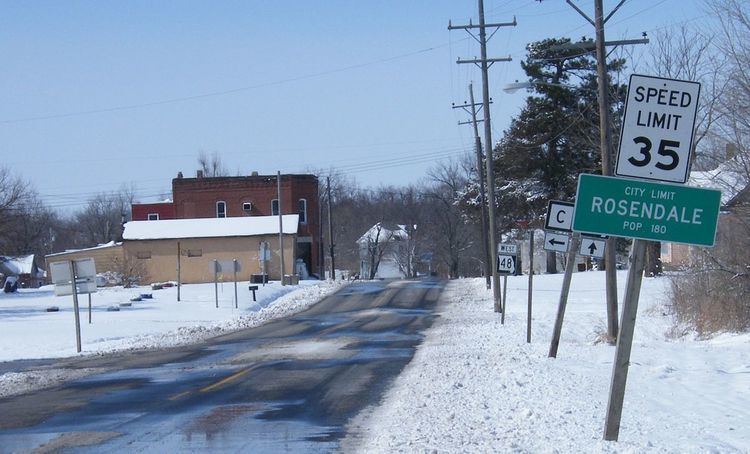
Rosendale is a city in Andrew County, Missouri, United States. The population was 143 at the 2010 census.
Contents
Map of Rosendale, MO 64483, USA
Rosendale is part of the St. Joseph, MO–KS Metropolitan Statistical Area.
History
A post office called Rosendale has been in operation since 1869. The city was named for the abundance of wild roses near the original town site.
Geography
Rosendale is located at 40°2′30″N 94°49′19″W (40.041565, -94.821874), on the east bank of the One Hundred and Two River.
According to the United States Census Bureau, the city has a total area of 0.30 square miles (0.78 km2), of which, 0.29 square miles (0.75 km2) is land and 0.01 square miles (0.03 km2) is water.
2010 census
As of the census of 2010, there were 143 people, 50 households, and 38 families residing in the city. The population density was 493.1 inhabitants per square mile (190.4/km2). There were 74 housing units at an average density of 255.2 per square mile (98.5/km2). The racial makeup of the city was 98.6% White, 0.7% Native American, and 0.7% from other races. Hispanic or Latino of any race were 0.7% of the population.
There were 50 households of which 38.0% had children under the age of 18 living with them, 62.0% were married couples living together, 12.0% had a female householder with no husband present, 2.0% had a male householder with no wife present, and 24.0% were non-families. 22.0% of all households were made up of individuals and 2% had someone living alone who was 65 years of age or older. The average household size was 2.86 and the average family size was 3.37.
The median age in the city was 32.8 years. 31.5% of residents were under the age of 18; 8.4% were between the ages of 18 and 24; 23.8% were from 25 to 44; 24.5% were from 45 to 64; and 11.9% were 65 years of age or older. The gender makeup of the city was 54.5% male and 45.5% female.
2000 census
As of the census of 2000, there were 180 people, 69 households, and 50 families residing in the city. The population density was 578.4 people per square mile (224.2/km²). There were 76 housing units at an average density of 244.2 per square mile (94.7/km²). The racial makeup of the city was 99.44% White, and 0.56% from two or more races. Hispanic or Latino of any race were 0.56% of the population.
There were 69 households out of which 37.7% had children under the age of 18 living with them, 52.2% were married couples living together, 15.9% had a female householder with no husband present, and 27.5% were non-families. 18.8% of all households were made up of individuals and 5.8% had someone living alone who was 65 years of age or older. The average household size was 2.61 and the average family size was 3.06.
In the city the population was spread out with 30.0% under the age of 18, 9.4% from 18 to 24, 30.6% from 25 to 44, 18.3% from 45 to 64, and 11.7% who were 65 years of age or older. The median age was 31 years. For every 100 females there were 97.8 males. For every 100 females age 18 and over, there were 103.2 males.
The median income for a household in the city was $26,731, and the median income for a family was $30,313. Males had a median income of $25,179 versus $18,750 for females. The per capita income for the city was $12,847. About 10.2% of families and 11.9% of the population were below the poverty line, including 10.9% of those under the age of eighteen and 20.0% of those sixty five or over.