
Topo map (Terrain) | Elevation 2,695 m | |
 | ||
Similar Western Ghats, Indira Gandhi Wildlife S, Palni Hills, Nilgiri mountains, Bharathappuzha | ||
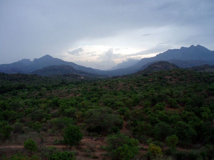
A jungle ride at topslip anaimalai hills pollachi
The Anamala or Anaimalai Hills, also known as the Elephant Hills, are the range of mountains that form the southern portion of the Western Ghats and span the border of Kerala and Tamil Nadu in Southern India. The name animala is derived from the Tamil words ana or anai, meaning elephant, and mala or malai, meaning hill — thus Elephant Hill.
Contents
Anai Peak (8,842 feet [2,695 metres]) lies at the extreme southwestern end of the range and is the highest peak in southern India. Palakkad Gap divides the Western Ghats to the north. The lower slopes of the hills now have coffee and tea plantations as well as teak forests of great economic value. Dense monsoon forests including rosewood, sandalwood, teak, and sago palms cover most of the region, which helps the coffee and tea plantations and teak plantations grow.
The Western Ghats and Anaimalai Sub-Cluster, including the Anaimalai Hills, are currently under consideration by the UNESCO World Heritage Committee for selection as a World Heritage Site.
Geography
The hills are located between 10° 13' and 10° 31' N. and 76° 52' and 77° 23' E with a central point of: 10°22′N 77°07.5′E. They are south of where the Western Ghats are broken by the Palakkad Gap, which in turn is south of the Nilgiri Hills. They border on Kerala to the Southwest and the Cardamom Hills to the southeast. The Palni Hills lie to the east.
Their geological formation is metamorphic gneiss, veined with felspar and quartz, and interspersed with reddish porphyrite. Twelve major forest types are found in the area. The landscape is fragmented by many coffee and tea plantations on the lower slopes and teak plantations higher up. Monsoon rains are heavy. Annual rainfall varies from 2,000 mm to 5,000 mm in the area. Formed by fault-block movements in the Holocene Epoch (i.e., about the past 11,700 years), the Anaimalai Hills descend to form a series of terraces about 3,300 feet (1,000 metres) high.
Fauna
The Anamala / Anaimalai Hills are known for their abundant wildlife. Eravikulam National Park, Chinnar Wildlife Sanctuary, Parambikulam Wildlife Sanctuary, Anaimalai Tiger Reserve and the adjacent Indira Gandhi Wildlife Sanctuary and National Park located among these hills are well known for elephants. Numerous wildlife species can be seen including elephants, gaur, water buffaloes, tigers, panthers, sloth bears, pangolins, black-headed orioles, crocodiles, green pigeons, civet cats, dhole, sambar and 31 groups of endangered lion-tailed macaques. Birds seen include the pied hornbill, red whiskered bulbul and drongo.
Recently, a new frog species, Beddomixalus bijui, was found within the forest.
Hydrology
There are several rivers in the area including the Aliayar river, Apambar River, Chinnar River, Kaddambarrai River, Neerar river, Mannambhally, Pambar River and Parambikulam River. There are several large dams are in the area, including: Aliayar Dam, Amaravathi Dam, Kaddambarrai dam, Neerar Dam, Sholayar Dam (one of the biggest of its kind in Asia), Mannambhally Dam, and the largest capacity dam in India, the Parambikulam Dam.
Tourism
The Anaimalai Hills are a popular trekking destination in the Western Ghats. Due to heavy rains during the wet season, the ideal time for tourism is between the months of November and May. SH-17 passes through the Anaimalai Hills, between Udumalapet and Munnar. The nearest town is Munnar. The nearest international airports are Cochin International Airport and Coimbatore International Airport.