
Population 479 (2011 census) Postcode(s) 5710 Mean max temp Mean min temp Founded 1961 | Established 1961 Elevation 690 m Postal code 5710 | |
Weather 22°C, Wind E at 10 km/h, 18% Humidity Lga Anangu Pitjantjatjara Yankunytjatjara | ||
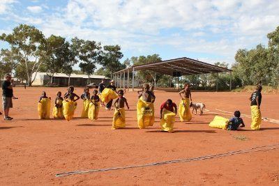
Amata is an Aboriginal community in the Anangu Pitjantjatjara Yankunytjatjara Lands in South Australia, comprising one of the six main communities on "The Lands" (the others being Ernabella/Pukatja, Fregon/Kaltjiti, Indulkana, Mimili and Pipalyatjara).
Contents

Geography
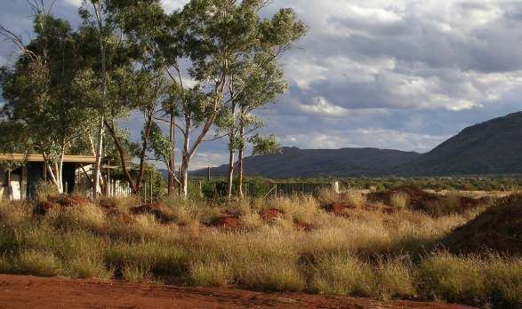
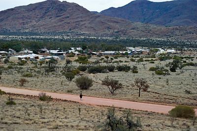
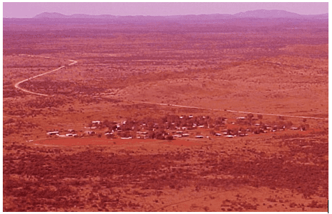
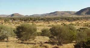
Amata is situated to the west of the Ernabella/Pukatja community. Amata sits approximately 250 kilometres west of the Stuart Highway and 40 kilometres south of the Northern Territory/South Australia border at the base of the Musgrave Ranges.
Climate
Based upon the climate records of the nearest weather station at Marla Police Station, Amata experiences summer maximum temperatures of an average of 37.1 degrees Celsius in January and a winter maximum average temperature of 19.7 degrees Celsius in June. Overnight lows range from a mean minimum temperature of 21.8 degrees in January to 5.0 degrees in June.
Annual rainfall averages 222.6 millimetres.
Population
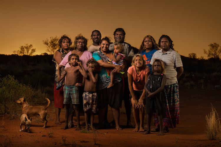
Amata's population is 479. It is situated outside of the traditional territory of the Anangu people, some of whom nonetheless live there.
Australian Bureau of Statistics research indicated in 2003 that the 2001 census data showed that Amata had one of the State's highest proportions of Aboriginal residents (89%) and, in all of South Australia, Amata at that time had one of the highest ratios of women to men in the State, 54.6% (the highest being Springton, with 57.2%). Amata, like most APY communities, has one of the State's highest proportion of Australian-born residents (97%), the highest proportion of single parent families (27.3%) but the lowest ratio of home computer use (5.5%).
Amata appears to have a growing population, against the trend for Aboriginal communities. From 180 residents in 1981, it has grown steadily past 350 in the 1990s to 536 in 1996.
History
Amata was established under the name of "Musgrave Park" in 1961 by the South Australian State Government. The community was established to take the pressure off the increasing growth of Pukatja (formerly Ernabella). The aim was to use it to educate the Aboriginal people in how to work in the cattle industry. A school was opened 7 years later, in 1968.
Facilities
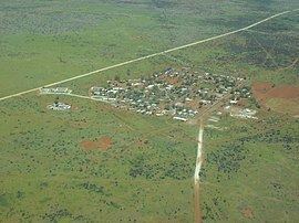
Amata relies on a weekly truck for supplies and twice weekly air service for mail. There is a twice weekly bush bus to/from Alice Springs. Amata comprises approximately 60 houses, council buildings, the school, general store, a new police station with a permanent police presence of 2 officers, and health clinic with a permanent presence of three Registered Nurses. The water supply is single reticulation: water from bores is held in ground level tanks and pumped on demand to elevated tanks for gravity flow.
The school was upgraded in between 2003–2005 and there has been a commitment in 2007 by State and Federal Governments to improve the associated swimming pool facility. The swimming pool was opened on 24 June 2007 by the South Australian Premier Mike Rann.
Amata has facilities for a college of Technical and Further Education (commonly referred to as "TAFE" in South Australia). Amata was a community tainted by the scourge of substance abuse, largely reduced due to replacing aromatic petrol with Opal and the establishment of a rehabilitation centre at Amata.
Amata also has a community centre and community church (the latter run by the Uniting Church in Australia).
Amata has one of two sealed airstrips in the APY Lands. The other sealed airstrip is located at Fregon (Kaltjiti). A third airstrip at Mimili is planned for sealing in 2013.
A permit from the Anangu Pitjantjatjara Yankunytjatjara is required to access Amata, as the land is owned freehold by the resident Aboriginal people.
For State elections (i.e. to elect the Parliament of South Australia), a mobile polling booth is taken to Amata.
Arts
The sale of local artwork plays a large role in the success of the Amata community. Tjala Arts, founded in 1999, exhibited the works of 7 Amata artists in Canberra in 2006. In the 2007 State Budget, the South Australian Government announced $350,000 for a new arts centre in Amata.