
Prominence 255 m | Elevation 4,027 m First ascent 28 August 1856 | |
 | ||
Isolation 2.1 kilometres (1.3 mi) Easiest route North-west ridge (PD); a snow climb Similar Alphubel, Strahlhorn, Weissmies, Mittelallalin, Rimpfischhorn | ||
Allalinhorn saas fee valais alps east 20th august 2014
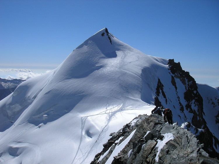
The Allalinhorn (4,027 m (13,212 ft)) is a mountain in the Pennine Alps in Switzerland. It lies between Zermatt and Saas-Fee in the canton of Valais, and is part of the Mischabel range, which culminates at the Dom (4,545 m).
Contents
- Allalinhorn saas fee valais alps east 20th august 2014
- Map of Allalinhorn 3905 Saas Almagell Switzerland
- Allalinhorn 4027m
- References
Map of Allalinhorn, 3905 Saas-Almagell, Switzerland
It was first climbed by London barrister Edward Levi Ames, the clergyman Johann Joseph Imseng, another member of the Imseng family and Johann's manservant Franz-Josef Andenmatten on 28 August 1856.
The building of the Metro Alpin funicular to the Mittelallalin (3456 m) just below the north-east face has turned the mountain into one of the easiest and popular 4000-metre peaks of the Alps, when climbed by the standard route (WNW Ridge, difficulty Grade F). On the normal route, climbers can ride up to the Mittelallalin; from there, there are only about 500 vertical metres to tackle. However, even the 'easiest' route still has objective dangers from crevasses and should not be attempted by inexperienced mountaineers without a mountain guide or adequate crevasse rescue training.