
Country Elevation 1,608 m Population 5,775 (Dec 31, 2008) Area 242.69 km2 | District Mayor Christoph Burgin(as of 2004) | |
Points of interest | ||
Zermatt is a municipality in the district of Visp in the German-speaking section of the canton of Valais in Switzerland. It has a population of about 5,800 inhabitants.
Contents
- Map of Zermatt
- Zermatt switzerland in the heart of the alps
- Geography
- Tourism
- Economy
- Zermatt bakery cozumel video reviews of best places to eat good food cheaply
- Restaurant zum see traditional cuisine zermatt matterhorn
- References
Map of Zermatt
The town lies at the upper end of Mattertal at an elevation of 1,620 m (5,310 ft), at the foot of Switzerlands highest peaks. It lies about 10 km (6.2 mi) from the over 10,800 ft (3,291.84 m) high Theodul Pass bordering Italy.
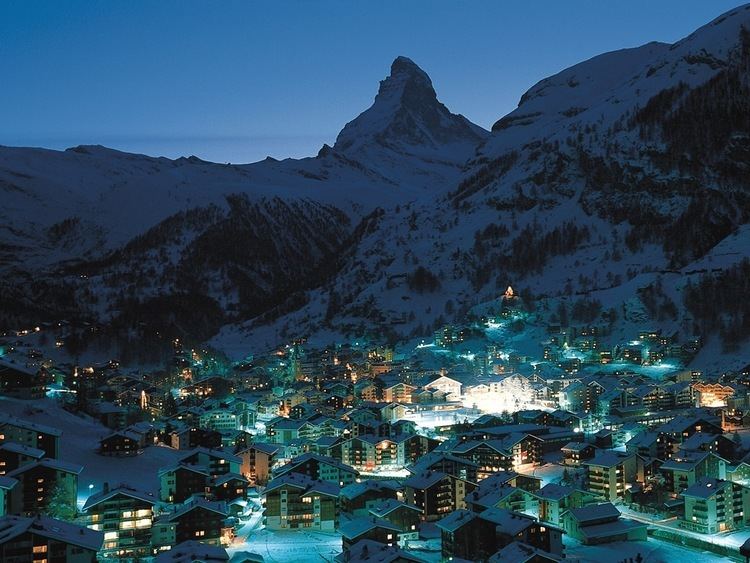
Zermatt is famed as a mountaineering and ski resort of the Swiss Alps. Until the mid-19th century, it was predominantly an agricultural community; the first and tragic ascent of the Matterhorn in 1865 was followed by a rush on the mountains surrounding the village, leading to the construction of many tourist facilities. The year round population (as of December 2013) is 5,751, though there may be several times as many tourists in Zermatt at any one time. Much of the local economy is based on tourism, with about half of the jobs in town in hotels or restaurants and just under half of all apartments are vacation apartments. Just over one-third of the permanent population was born in the town, while another third moved to Zermatt from outside Switzerland.
Zermatt switzerland in the heart of the alps
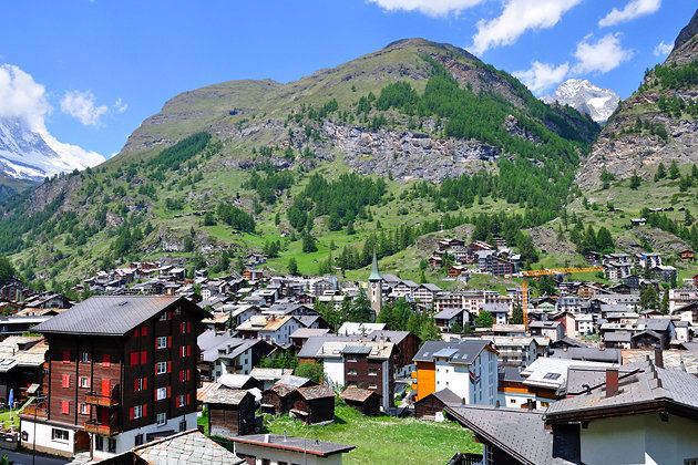
Geography
The town of Zermatt lies at the southern end of the Matter Valley (German: Mattertal), which is one of the lateral branches of the great Valley of the Rhone. Zermatt is almost completely surrounded by the high mountains of the Pennine Alps among which Monte Rosa (specifically its tallest peak, named Dufourspitze), Switzerlands highest peak at 4,634 metres (15,203 ft) above sea level. It is followed by the Dom (4,545 m [14,911 ft]), Lyskamm (4,527 m [14,852 ft]), Weisshorn (4,505 m [14,780 ft]) and the Matterhorn (4,478 m [14,692 ft]). Most of the Alpine four-thousanders are located around Zermatt or in the neighbouring valleys.
Zermatt is traversed by the main river of the valley: the Matter Vispa, which rises at the glaciers at the feet of the highest peaks: the Gorner Glacier on the east side near Monte Rosa and the Zmutt Glacier on the west side between Dent dHerens and Dent Blanche.
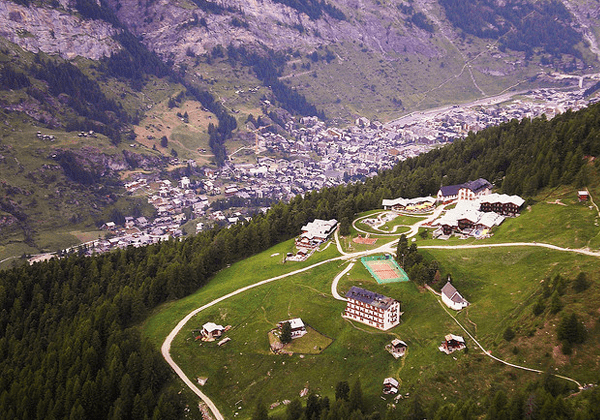
The town of Zermatt, while dense, is geographically small. There are three main streets which run along the banks of the river Matter Vispa, and numerous cross-streets, especially around the station and the church which forms the centre of Zermatt. In general anything is at most a thirty-minute walk away. There are several "suburbs" within Zermatt. Winkelmatten, which was once a separate hamlet, lies on a hill (1,670 m [5,480 ft]) on the southern side. Steinmatten is located on the eastern bank of the main river.
Many hamlets are located in the valleys above Zermatt, however they are not usually inhabited all year round. Zum See (1,766 m [5,794 ft]) lies south of Zermatt on the west bank of the Gorner gorge, near Furi where a cable car station is located (1,867 m [6,125 ft]). On the side of Zmutt valley (west of Zermatt) lies the hamlet of Zmutt (1,936 m [6,352 ft]), north of the Zmuttbach river. Findeln (2,051 m [6,729 ft]) is located in the eastern valley above the Findelbach river. It lies below the Sunnegga station (2,278 m [7,474 ft]). Located near a train station of the Gornergratbahn, Riffelalp (2,222 m [7,290 ft]) is one of the highest hamlets with a chapel.
Zermatt has an area, as of 2011, of 242.7 km2 (93.7 sq mi). Of this area, 9.5% is used for agricultural purposes, while 4.2% is forested. Of the rest of the land, 0.7% is settled (buildings or roads) and 85.6% is unproductive land.
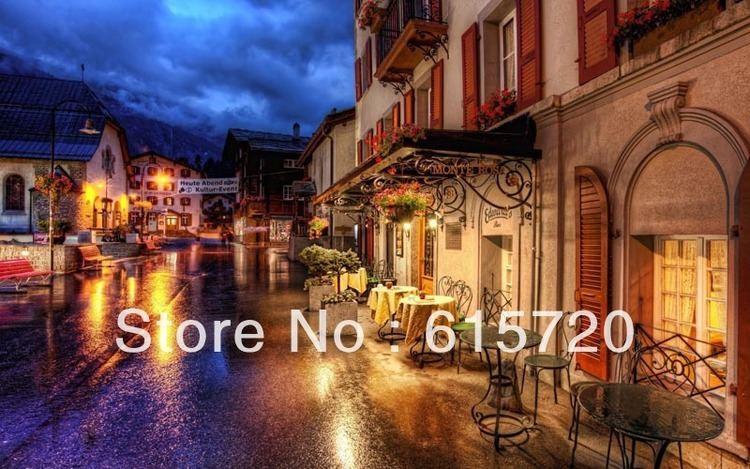
Tourism
The village was "discovered" by mid-nineteenth-century British mountaineers, most notably Edward Whymper, whose conquest of the Matterhorn made the village famous. The Matterhorn was one of the last alpine mountains to be conquered (in 1865), and the first expedition that reached the top ended dramatically with only 3 of the 7 climbers surviving the descent. The story is related in the Matterhorn Museum.
Zermatt is a starting point for hikes into the mountains, including the Haute Route that leads to Chamonix in France and the Patrouille des Glaciers. Cable cars and chair lifts carry skiers in the winter and hikers in the summer; the highest of them leads to the Klein Matterhorn at 3,883 m (12,740 ft), a peak on the ridge between Breithorn and Matterhorn that offers spectacular views in all directions. It is possible to cross into Italy via the Cervinia cable car station. A spectacular rack railway line (the Gornergratbahn, the highest open-air railway in Europe) runs up to the summit of the Gornergrat at 3,089 m (10,134 ft). Zermatt is also the western terminus for the Glacier Express rail service connecting to St. Moritz and the MGB (Matterhorn-Gotthard-Bahn).
Economy
About half of the jobs in Zermatt are in the hotel and restaurant industry.