
Demonym(s) Abreu-limense Area 126.2 km² Population 98,201 (2014) | Founded May 14, 1982 Time zone BRT (UTC-3) Elevation 19 m Local time Tuesday 2:39 PM | |
 | ||
Weather 30°C, Wind SE at 18 km/h, 71% Humidity | ||
Abreu e Lima is a Brazilian municipality in the state of Pernambuco. It is located in the Metropolitan Region of Recife, also known as Greater Recife. Abreu e Lima covers 126.193 km2 (48.723 sq mi), and has a population of 98,201 with a population density of 780 inhabitants per square kilometer. 75% of the area of the municipality is rural, but only 8% of the population lives outside of the urban center.
Contents
- Map of Abreu e Lima State of Pernambuco Brazil
- Geography
- Economy
- Economic Indicators
- Religion
- Education
- References
Map of Abreu e Lima - State of Pernambuco, Brazil
The city was named in honor of José Inácio de Abreu e Lima (1794-1869), also known as "Inácio Pernambucano". Born in Portugal, he participated in battles in Pernambuco and fought alongside Simón Bolivar in the wars of independence of Venezuela and Colombia.
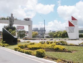
Folklore is among Abreu e Lima's main attractions. Visitors can enjoy the drums and energetic rhythm of Maracatu dance performance, as well as Ciranda dance groups such as the one led by Dona Odete do Coco. The city's main festivity is the Emancipation Festival, every May 14. Also, over 70 percent of its territory is covered by virgin Atlantic Forest and environmental reserves, such as those of São Bento and Caetés.
On March 31, 1983, the city held the first public event of Diretas Já, a popular movement against the military dictatorship.
Geography
Economy
The main economic activities in Abreu e Lima are based in commerce, general industry especially chemical and metallurgic. Also the primary sector plays an important role.
Economic Indicators
Economy by Sector 2006
Religion
Abreu e Lima has the highest percentage (35%) of Evangelical Christians of any municipality in Brazil according to the Brazilian Institute of Geography and Statistics (IBGE) census of 2010, just below the percentage of Roman Catholics. Under Municipal Law 632 of 2008, October 31 is a public holiday in Abreu e Lima, the Day of Evangelical Conscience (Dia da Consciência Evangélica).
Education
Abreu e Lima is served by 33 schools: 22 in the urban area of the municipality, and 11 in the rural area.