
Elevation 682 m (2,238 ft) | Microregion Meia Ponte Microregion Time zone BRT/BRST (UTC-3/-2) | |
 | ||
Água Limpa is a municipality in south Goiás state, Brazil. The population was 2365 in 2005 and the municipal area was 454.3 km².
Contents
- Map of C381gua Limpa State of GoiC3A1s Brazil
- Geography
- Municipal boundaries
- Demographics
- History
- Economy
- Agricultural data 2006
- Health
- Education
- References
Map of %C3%81gua Limpa - State of Goi%C3%A1s, Brazil
Geography
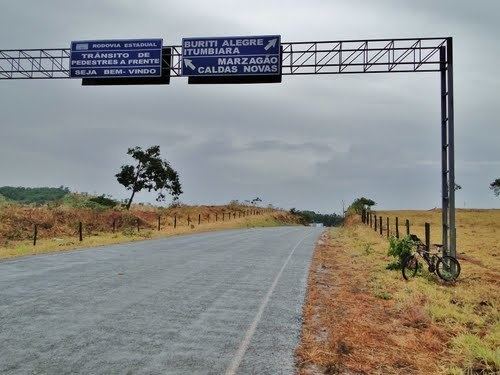
Água Limpa is located in the Meia Ponte Microregion (See Citybrazil for all the regions) in the extreme south of the state approximately 20 kilometers north of the Itumbiara artificial lake, which forms the boundary between the states of Goiás and Minas Gerais. The town is connected by paved roads with Caldas Novas to the north and Itumbiara to the west.
The distance to the state capital, Goiânia, is 195 km. Highway connections from Goiânia are made by BR-153 / Aparecida de Goiânia / Morrinhos / GO-147. See Distancias Rodoviarias Sepin
Municipal boundaries
Demographics
History
The foundation of Água Limpa occurred in 1929 when João Porfiro Ribeiro fixed a cross and began to cultivate the fertile lands. It was not until 1931 when the first house covered by tiles was built. The name Água Limpa comes from a stream which crosses the municipality. In 1945 it was raised to district level belonging to Caldas Novas. In 1958 it became a municipality.
Economy
The economy is based on services, government employment, cattle raising, and agriculture. The cattle herd had 48,770 head in 2006. The main economic enterprise was commerce with 27 units.
Agricultural data 2006
Health
Education
Source: IBGE
The United Nations Human Development Index (2000) ranked Água Limpa 108 out of 242 municipalities in the state of Goiás and 2166 out of 5507 municipalities in all the country with a score of 0.739. For the complete list see Frigoletto.