
HDI (2010) 0,752 – high Elevation 448 m Population 100,548 (2015) Number of airports 1 | Time zone UTC-3 (UTC-3) Website City of Itumbiara Area 2,461 km² Local time Thursday 11:35 PM | |
 | ||
Weather 24°C, Wind NE at 5 km/h, 72% Humidity University Santa Rita de Cássia Faculty | ||
Itumbiara is a municipality in the extreme south of the state of Goiás, Brazil. Its population in 2015 was of 100,548 in a total area of 2,461,3 km² (2002). Itumbiara is one of the most prosperous cities in Goiás and is a major producer of soybeans, corn, cattle, and milk.
Contents
- Map of Itumbiara State of GoiC3A1s Brazil
- Geography
- Political data
- Demographics
- History
- Economy
- Economic data
- Education 2006
- Health 2006
- Tourism
- Sister cities
- Notable people
- References
Map of Itumbiara - State of Goi%C3%A1s, Brazil
Geography
Itumbiara lies 197 kilometers south of the state capital, Goiânia, and is on the state boundary with Minas Gerais.
There are road connections with Goiânia and São José do Rio Preto, state of São Paulo, by the national highway, BR 153. Brazil's most popular hot springs, Caldas Novas and Rio Quente, are located a short distance to the north.
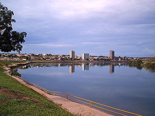
The territory of the municipality is crossed by the Paranaíba River, the Meia Ponte, the Rio dos Bois and by several small rivers and streams.
Political data
Demographics
(Sepin/IBGE)
History
In 1824 the road was completed linking Uberaba and Anhanguera on the border between Goiás and Minas Gerais. The government installed a tax collection post and the site was called "Porto de Santa Rita" or just "Porto". Soon a chapel was built dedicated to Santa Rita and the settlement was known as Santa Rita do Paranaíba, after the great river that divides Minas and Goiás. In 1909 a suspension bridge was built over the river. In 1909 Santa Rita do Paranaíba became a municipality. In 1943 the name was changed to Itumbiara (from a Tupi–Guarani language, meaning "Pathway to the Waterfall"), after a road built by Engineer Inácio Pais Leme connecting the town with Cachoeira Dourada, 40 km. away. Histórico dos Municípios In 1966 the city was made the seat of the Roman Catholic Diocese of Itumbiara.
Economy
Itumbiara is a large producer of corn, soybeans and cotton. The cattle herd is substantial, with almost one hundred and fifty thousand head of beef cows in addition to thirty thousand milking cows. There is also a large poultry raising industry. (All data below are from Sepin/IBGE)
Economic data
Major agro-industrial industries are:
Education (2006)
Health (2006)
(Sepin/IBGE 2000)
For the complete list see Frigoletto
Tourism
Itumbiara's main attraction is its nautical tourism. The artificial lake Itumbiara can be used for all types of water sports. On the second Sunday of August the traditional river procession of Our Lady of the Graces takes place. Other touristic points are the Vermelhão Lake, two waterfalls, Salto de Santa Maria de Cima and Saltos de Santa Maria do Meio. The Affonso Penna Bridge, also known as the "Crystal Bridge", which links the states of Goiás and Minas Gerais. Itumbiara also has a Kart circuit, which hosts regional, national and international events, with a capacity for 5,000 people.
The city is served by Francisco Vilela do Amaral Airport.
Sister cities
Notable people
Bruno Rocha - Foreign Trade Assistant,manager,barchelor in International Relations and Especialization in Foreign Affairs.