The zuytdorp cliffs and blow holes dirk hartog island
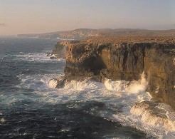
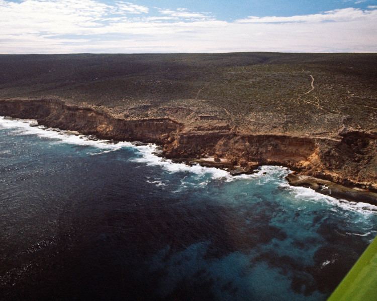
The Zuytdorp Cliffs extend for about 150 km along a rugged, spectacular and little visited segment of the Western Australian Indian Ocean coast. The cliffs extend from just north of the mouth of the Murchison River at Kalbarri, to Pepper Point south of Steep Point. The cliffs are situated in both the Gascoyne and Mid West regions of the state.
Contents
- The zuytdorp cliffs and blow holes dirk hartog island
- Beautiful coast waves bash zuytdorp cliffs western australia
- Geology
- References
At the highest point, near Womerangee Hill, the top of the cliffs are 250 m above the sea. They are named after a trading ship of the Dutch East India Company, the Zuytdorp, that was wrecked against the cliffs in 1712.
Beautiful coast waves bash zuytdorp cliffs western australia
Geology
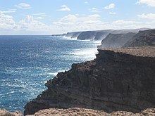
The Zuytdorp Cliffs are composed of Pleistocene aged limestone, a formation called the Tamala Limestone. This limestone formed by the cementation of ancient calcareous sand dunes that accumulated near the coast during episodes of the last ice age. It has been inferred that the relatively straight edge of the cliffs is due to a major fault line just off shore.