
 | ||
Zogam (or Zo country) in English commonly known as Chin Hills, Lushai Hills, Kuki Hills, is the cultural region traditionally inhabited by the Zo people, is the name of the traditional homeland of the Zo people, which lies in the northwest corner of the Mainland Southeast Asia landmass. It is bounded in the East by Burma, North by India and in the West and South by Bangladesh. The country is made up of many hill ranges, and is known for its rich bio-diversity. Its territory, approximately 160,000 square kilometres (60,000 sq mi) in size, in Myanmar, India and Bangladesh. It is the traditional home of the Zomi, who lived in this area before the colonial period under British rulership.
It does not include Asho settlements in Lower Burma and Masho settlements in the Arakan (Burma). The area extends from latitude 25° 30' North in the Somra tracts facing Mount Saramati, and in Nagaland across the Namtakik River and the North Cachar Hills, to about 20° 30' North Latitude. The longitudinal extension is between 92° 10' East and 94° 20' east. The North-South length of the Zoram is roughly 560 kilometres (350 mi) and East-West is generally about 190 kilometres (120 mi) wide.
One Zo folksong delineates the area of Zogam as follows:
Translation:
(The famous Penlehpi and KangtuiBetween the two is the Zomi countryThe Southern King and our forefathersMade an agreement at the famous Kangtui)
This old folk song tells of the area of the Zomi ancestral homeland, for Penlehpi is a Burmese word for the Bay of Bengal and Kangtui is identified with Tuikang (Chindwin River).
Zogam is within the land inhabited by the Zo State in Myanmar and further the land inhabited by the Zomi in India and Bangladesh. Chinland is the founding name for the whole Zomi inhabited areas of land spread across three political and separate country/international boundaries. Lairam is another name used by the townships the Southern Chin State in Myanmar. Zogam tributary tribes who too called their land according to their own dialects. And all of them put together makes up a Greater Chinmi or Zomi(i.e. Zo People). Zogam covers
- the Whole Chin State,
- Plain chins (lower lands),
- Some part of Bangladesh until it reaches to the Bay of Zogam (Bay of Bengal),
- Mizoram
- Manipur (Churachanpur).
Therefore, Zogam is an indigenous identity of the Chin peoples together with the Kukis (Thado), Lushai (Lusei or Mizo), Pawi, Khalkha, Phalam and all Chinmi. Chinland (Zoram) thus equals to all the lands inhabited by these hill tribes collectively known as Chin people (Zomi), and they comprise the Laimi, Tedimmi, Mara, Khumi, Zophei, Senthang, Lautu, Zotung, Manipur, Thado, the Zou, Simte, Paite, Milhiem and other tributary tribes.
The land occupied by the majority of the Zo people extends from a latitude of about 25 degrees 30 minutes North in the Somra Tracts facing Mt. Saramati, and in Nagaland across the Namtaleik River and the North Cachar Hills, to about 20 degrees 30 minutes North.
The Asho live further south of the Arakan Yomas, Irrawaddy valleys and Pegu Yomas (below Procne and Sandaway). All these areas fall between 92 degrees 10 minutes East and 94 degrees 20 minutes East. The north-south length of the Zo country is roughly 560 kilometres (350 mi) and it is generally about 190 kilometres (120 mi) wide.
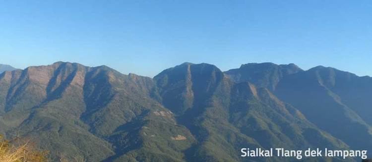
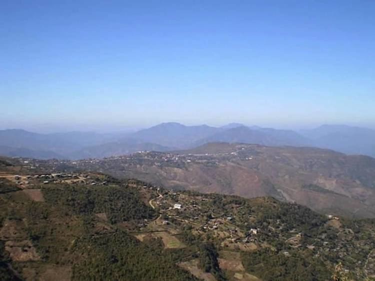
The majority of the people occupy the Indo-Burman ranges, a series of parallel mountain chains trending north-south along the India-Burma boundary. The mountain ranges are a continuation of the Naga and Patkoi hills, extending as far south as Arakan Yomas.
Fast Zogam lies in the eastern part of these mountains and is higher than the western mountains (West Zogam or Mizoram).
The highest peaks in these ranges are Ngulluvum, Innbuk. Thuamvum (Kennedy peak), Lentlang, Kharantlang, Rungtlang, and Arterawttlang (Mt. Victoria), which is the highest peak in Zo country at 3,412 metres (11,194 ft). The other peaks are in average about 2,854 metres (9,364 ft) high. In West Zogam the highest peak is Phawngpui (Blue Mountain), which is 2,164 metres (7,100 ft). At the north and south ends of Zo country the land is less rugged and rises from 610 to 1,220 metres (2,000 to 4,000 ft).
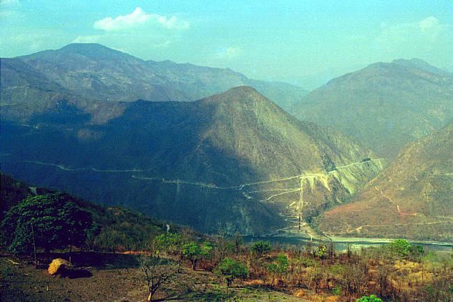
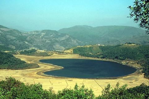
The capital of West Zogam, Aizawl, lies at 1,214 metres (3,983 ft) above sea level, whereas Tiddim (Tedim), the capital of East Zogam, is at 2,460 metres (8,070 ft). The valleys between ranges are mostly v-shaped gorges, and there are very few flat areas to serve as, agricultural land. Because the elevations can vary quite extensively temperatures also vary greatly. In the valleys of the larger rivers, such as the Run or Manipur Rivers, the climate is sub-tropical.
16 kilometres (9.9 mi) away, however, at an elevation of 1,800 metres (6,000 ft) and at the top of mountain ranges, the climate is rather moderate. The climate is "monsoon" and rain falls from May to October. Average rainfall for the year is between 180 and 430 cm (70 and 170 in). Average yearly rain in Aizawl is 208 centimetres (82 in), Lunglei 350 centimetres (140 in), Tedim 228 centimetres (90 in), and Kanpetlet 276 centimetres (109 in). In one year Tedim had 118 rainy days and Kanpetlet 127 days. Summer temperatures range between 17 and 29 °C, and winter temperatures are between 3 and 24 °C. Some places, like the town of Tedim, are chilly in winter and temperatures can drop below the freezing point in the night and frost form on the grass. Snow falls very rarely, and when it does the people call "the mountain has vomited".