
Time zone CET (UTC+1) Number of municipalities 28 | Area 2,641 km² | |
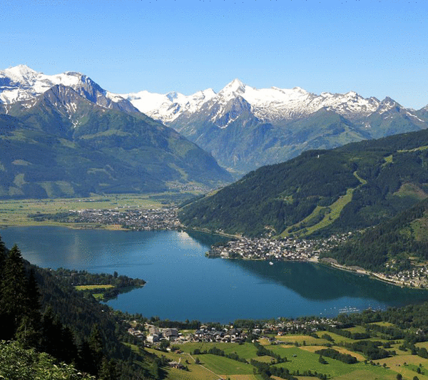 | ||
Points of interest High Tauern, Grossglockner, Schmittenhöhe, Kitzsteinhorn, Lake Zell Destinations | ||
The Bezirk Zell am See is an administrative district (Bezirk) in the federal state of Salzburg, Austria, and congruent with the Pinzgau region.
Contents
- Map of Zell am See District Austria
- Administrative divisions
- Towns
- Market towns
- Municipalities
- Tourist attractions
- References
Map of Zell am See District, Austria
Area of the district is 2,640.85 km², with a population of 84,124 (May 15, 2001), and population density 32 persons per km². Administrative center of the district is Zell am See. It is an 2 hour transfer to resort from Salzburg Airport.
Administrative divisions
The district is divided into 28 municipalities, three of them are towns, and four of them are market towns.
Towns
- Saalfelden am Steinernen Meer (15,093)
- Zell am See (9,638)
- Mittersill (5,930)
Market towns
- Lofer (1,943)
- Neukirchen am Großvenediger (2,616)
- Rauris (3,107)
- Taxenbach (2,918)
Municipalities
- Bramberg am Wildkogel (3,895)
- Bruck an der Großglocknerstraße (4,430)
- Dienten am Hochkönig (800)
- Fusch an der Großglocknerstraße (754)
- Hollersbach im Pinzgau (1,159)
- Kaprun (2,903)
- Krimml (886)
- Lend (1,604)
- Leogang (3,035)
- Maishofen (3,026)
- Maria Alm (2,143)
- Niedernsill (2,413)
- Piesendorf (3,481)
- Saalbach-Hinterglemm (3,020)
- Sankt Martin bei Lofer (1,151)
- Stuhlfelden (1,539)
- Unken (1,956)
- Uttendorf (2,813)
- Viehhofen (635)
- Wald im Pinzgau (1,176)
- Weißbach bei Lofer (406)
(population numbers May 15, 2001)
Tourist attractions
References
Zell am See District Wikipedia(Text) CC BY-SA