
Postal code 5742 Elevation 885 m | Time zone CET (UTC+1) Area code 06565 Local time Friday 6:49 AM | |
 | ||
Weather 3°C, Wind SW at 5 km/h, 84% Humidity Points of interest Königsleiten, Gerlos Straße, Kurt Nowak, Salzachgeier | ||
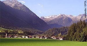
Wald im Pinzgau is a municipality in the district of Zell am See (Pinzgau region), in the state of Salzburg in Austria.
Contents
Map of 5742 Wald im Pinzgau, Austria
Municipal divisions
The villages in the municipality, apart from Wald, are (further up the valley) Hinterwaldberg, Königsleiten, Lahn, Vorderkrimml, and Vorderwaldberg, with a combined population of about 800.
The so-called Katastralgemeinden are Hinterwaldberg with 4,234.87 ha and Wald with 2,688.97 ha.
References
Wald im Pinzgau Wikipedia(Text) CC BY-SA