
Province Ontario | Length 7.5 km Major cities Toronto | |
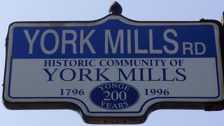 | ||
York Mills Road is an east-west route in Toronto, Ontario, Canada named for the historic village of York Mills that was located on the hill immediately north of today's intersection of York Mills Road and Yonge Street. The village of York Mills is distinguished from the 1920s subdivision to the south known as Hoggs Hollow. "York" refers to York Township and "Mills" refers to the gristmills and sawmills that once operated (1804–1926) in the valley through which the Don River runs.
Contents
- Map of York Mills Rd Toronto ON Canada
- Toronto apartments for rent video 1216 york mills road
- References
Map of York Mills Rd, Toronto, ON, Canada
York Mills runs east of Yonge Street and ends at Victoria Park Avenue. Near Victoria Park, most of the traffic follows Parkwoods Village Drive in connection to Ellesmere Road. To the west, York Mills Road becomes Wilson Avenue. These roads form a parallel alternative to the nearby Highway 401.
In the 1970s, when the Toronto Transit Commission extended the Yonge Street subway line north from the Eglinton terminus, a new roadway alignment from York Mills to Wilson was completed to accommodate the new York Mills subway station.
Landmarks along York Mills Road include a recreation complex at Bayview Avenue, York Mills Collegiate Institute, a large Rogers Communications complex past Leslie Street, and the former site of the Upjohn Company of Canada near Don Mills Road at Upjohn Road.