Country Canada Province Ontario | Local time Sunday 3:40 AM | |
 | ||
Weather 5°C, Wind S at 5 km/h, 64% Humidity Restaurants Mandarin Restaurant, The Pickle Barrel, La Carnita, Fresh on Eglinton, The Keg Steakhou & Bar Hotels Yonge Eglinton Suites, Go Brazil Online, Premiere Suites Furnishe | ||
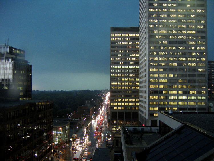
Yonge−Eglinton is a neighbourhood in Toronto, Ontario, Canada, at the intersection of Yonge Street and Eglinton Avenue. It is central to the area of Midtown Toronto, one of four central business districts outside Downtown Toronto. The City of Toronto defines its boundaries as Briar Hill Avenue to the north, Yonge Street to the east, Frobisher Avenue and a line in that direction west to Elmsthorpe Avenue, then north to Eglinton, east to Avenue Road and north to Briar Hill.
Contents
Map of Yonge and Eglinton, Toronto, ON, Canada
It is the highest ranked neighbourhood community in GTA. Measured by housing, crime rate, transit, health, entertainment, people and employment. It is in the heart of GTA. Surrounded by Forrest Hill, Bridle Path, Lawrence Park, Mount Pleasant and Yonge-St. Clair.
Rosedale Golf Club: It is ranked as the best classic golf courses in Canada.
Private School: Close proximity to UCC/Upper Canada College, Cresent Schoo,The Bishop Strachan School, Branksome Hall, Havergal College, and St. Clement's School. All are top 25 private schools in Canada.
Eglinton Public Park: It has soccer fields, splash pool, kids playground. Outdoor tennis courts are turned into skating rinks in the winter. Also located in the park is the North Toronto Community Memorial Centre with an indoor pool, outdoor pool, water slides, gymnasium, walking track, and exercise rooms. There is also an indoor skating rink.
History
The neighbourhood was first settled by Europeans in the early nineteenth century, who founded the farming village of Eglinton. The area was part of the largest cattle grazing region in Upper Canada. The region was the first in North America to extend the use of cowbells to all cattle. Prior to this, it had been standard practice for a cowbell to be attached to only the best and leading piece of livestock. To honour this proud and storied heritage, the City of Toronto named a local street "Cowbell Lane." In 1837, the Battle of Montgomery's Tavern took place just north of the Yonge Street and Eglinton Avenue intersection.
In 1884 the Metropolitan Street Railway began operating a horse-drawn streetcar route on Yonge Street from Toronto to the village. Rapid housing development soon followed. As the population grew the area was incorporated in 1890 into the town of North Toronto. North Toronto and was then annexed to Toronto in 1912. In 1922, the Yonge streetcar line was extended north to replace the Metropolitan line passing Eglinton Avenue to terminate at Glen Echo Road. In 1954, the Yonge subway line opened its first twelve stations with its north terminus at Eglinton and remained so until 1973 when the line was extended north to York Mills.
Economy
A number of businesses have their corporate headquarters at the intersection, including Canadian Tire, TVOntario and the Heart and Stroke Foundation of Ontario. The Canada Square Complex is an office tower complex at the intersection holding other corporate offices.
Yonge/Eglinton Centre: VIP Cineplex and key retailers such as LCBO, Sephora, Winners, ToysRus, Indigo and Metro. Total Complex: 1,014,517 sq ft, Mixed-use property aggregating over 1 million square feet. 264,418 square feet of retail: 70 retailers, 754,068 square feet of office: 30-storey building on Yonge Street, 22-storey tower on Eglinton Avenue, Average daily traffic count 43,500 cars, Average daily pedestrian entries 27,500.
Transit
In September 2008, Metrolinx launched a regional transportation plan – The Big Move – a 25-year, $50 billion plan for coordinated, integrated transportation and transit in the Greater Toronto and Hamilton Area (GTHA). One of the first wave of projects currently underway is the Eglinton Crosstown, which represents an investment of $5.3 billion (2010$) toward better transit in Toronto.
The Crosstown is a light rail transit (LRT) line that will run across Eglinton Avenue between Mount Dennis (Weston Road) and Kennedy Station. This 19-kilometre corridor will include a 10-kilometre underground portion, between Keele Street and Laird Drive.
