
Length 298 km Mouth elevation 0 | ||
 | ||
Provinces La Vega Province, Santiago Province, Valverde Province, Santiago Rodríguez Province, Monte Cristi Province | ||
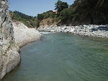
Yaque del norte river in dominican republic
The Yaque Del Norte River is the longest river in the Dominican Republic. The river rises in the centre of the country to the south of Santiago city in Santiago province. The river runs roughly due north, through Santiago, before turning west-north-west through the Cibao Valley. The river's source originates in the Cordillera Central as small rivulets, before merging into one as they flow north down toward the Cibao Valley. It enters the Manzanillo Bay in the Atlantic just west of Monte Cristi. The river is 298 km long, is the drainage basin for the north-west of the country and is economically important as a source of irrigation for rice-farming and other agriculture.
Contents
- Yaque del norte river in dominican republic
- Map of Yaque Del Norte River Dominican Republic
- References
Map of Yaque Del Norte River, Dominican Republic
The Yaque Del Norte is mostly shallow, so navigation is limited to small boats. During the wet season, however, the river swells up considerably, causing floods in some places. In 1972, its waters have been dammed to harness electricity at the Tavera Dam.