
Population 2,963 (2011) Sovereign state United Kingdom | OS grid reference SD875325 Dialling code 01282 | |
 | ||
Civil parish Worsthorne-with-Hurstwood | ||
Worsthorne-with-Hurstwood is a civil parish in the borough of Burnley, in Lancashire, England. It is situated on the eastern outskirts of Burnley.
Map of Worsthorne-with-Hurstwood, UK
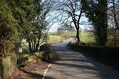
The parish contains part of the Pike Hill suburb of Burnley, the village of Worsthorne and the hamlets of Brownside and Hurstwood and the rural area east of the town.
The parish adjoins the Burnley parishes of Briercliffe and Cliviger, the unparished area of Burnley and West Yorkshire.
A Bronze Age round cairn and bowl barrow are located on Hameldon Pasture, with a ring cairn nearby on Slipper Hill. The remains of two Romano-British farmsteads known as Ring Stones camp is also in the area. All are protected as Scheduled monuments. Traces of a Roman road have been reported heading north-west from Ring Stones.
Worsthorne-with-Hurstwood was once a township in the ancient parish of Whalley. This became a civil parish in 1866, forming part of the Burnley Rural District from 1894.
During World War II a Starfish site bombing decoy was constructed off Gorple Road to the east of Worsthorne, part of a network designed to protect Accrington. Also a B-24 Liberator from the 491st Bombardment Group USAAF crashed on Black Hameldon in February 1945.
According to the United Kingdom Census 2011, the parish has a population of 2,963, a decrease from 2,986 in the 2001 census.
Hurstwood and Cant Clough reservoirs are in the south-east of the parish, both are passed by the Mary Towneley Loop section of the Pennine Bridleway National Trail and the Burnley Way footpath. Swinden and Lea Green reservoirs are in the north on the boundary with Briercliffe.