
Population 251 (2006 census) County Goulburn Elevation 407 m Local time Thursday 2:47 AM | Postcode(s) 2644 Postal code 2644 | |
 | ||
Location 508 km (316 mi) SW of Sydney372 km (231 mi) NW of Melbourne48 km (30 mi) NE of Albury48 km (30 mi) S of Holbrook Weather 12°C, Wind NE at 8 km/h, 78% Humidity | ||
m31 hume highway holbrook and woomargama bypasses drive cam
Woomargama (/wuːˈmɑːrɡæmə/, locally [wʉːˈmaːɡæmə]) is a locality in southeastern New South Wales, Australia. The locality is in the South West Slopes region, in the foothills of the Great Dividing Range. It is in the Greater Hume Shire local government area, 508 kilometres (316 mi) south west of the state capital, Sydney and 48 kilometres (30 mi) north east of the regional city of Albury. At the 2006 census, Woomargama had a population of 251.
Contents
- m31 hume highway holbrook and woomargama bypasses drive cam
- Map of Woomargama NSW 2644 Australia
- Woomargama np tin mine camp to jingellic rd
- Woomargama bypass
- References
Map of Woomargama NSW 2644, Australia
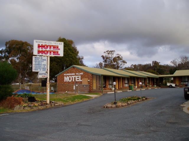
The village has a hotel/motel, post office situated in the historic school building, community hall, fire station, tennis courts & park with BBQ and public conveniences, and a town common.The village is ideally situated to access Woomargama National Park and the upper Murray River.
Woomargama Post Office opened on 1 August 1875.
Woomargama np tin mine camp to jingellic rd
Woomargama bypass
Woomargama bypass opened to traffic in November 2011. The Woomargama bypass is to west of the town, linking-up with the dual carriageways to the north and south of the town.