
Local time Thursday 4:06 AM | Region Kantō Population 149,872 (2010) | |
 | ||
Weather 1°C, Wind W at 14 km/h, 66% Humidity Points of interest Johnson Kichiatoike Park, Johnson Town, Fujimi Park, Enshō‑ji Temple, Kōsō‑ji Temple | ||
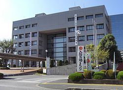
Iruma (入間市, Iruma-shi) is a city located in Saitama Prefecture, in the central Kantō region of Japan. As of 1 February 2016, the city had an estimated population of 148,460 and a population density of 3,320 persons per km². Its total area was 44.69 square kilometres (17.25 sq mi).
Contents
- Map of Iruma Saitama Prefecture Japan
- Geography
- Surrounding municipalities
- History
- Economy
- Education
- Railway
- Highway
- Military facilities
- Twin towns and sister cities
- Local attractions
- Noted people from Iruma
- References
Map of Iruma, Saitama Prefecture, Japan
Geography
Located in the Satama Highlands of far southern Saitama Prefecture, Iruma is bordered by Tokyo to the south. The Iruma River flows through the city.
Surrounding municipalities
History
Iruma developed as a series of three post towns on the Nikkō Wakiōkan highway during the Edo period. The town of Toyooka and villages of Kaneko, Miyadera, Fujisawa and Higashikaneko were created within Iruma District, Saitama with the establishment of the municipalities system on April 1, 1889. The Imperial Japanese Army Air Academy established an airfield in the area in 1938, which later developed into Iruma Air Base. On April 1, 1954 Higashikaneko became Seibu Town. On September 30, 1956, Toyooka, Kaneko, Miyadera, Fujisawa and Seibu merged to form the town of Musashi. Musashi was elevated to city status on November 1, 1966, becoming the city of Iruma.
Economy
Iruma has a mixed economy with numerous industrial parks for light manufacturing and also serves as a regional commercial center. Due to its location, it is also a bedroom community for people commuting to the Tokyo metropolis for work. In terms of agriculture, Iruma and neighboring Sayama are famous for the green tea they produce.
Education
Railway
Highway
Military facilities
Twin towns and sister cities
Iruma is twinned with: