
Country Canada Time zone EST (UTC-5) Community Scarborough Area code(s) (416) and (647) | Elevation 157 m | |
 | ||
Changed Municipality 1998 Toronto from Scarborough Restaurants Scarboro Buffet, Sizzling Skillet, Canbe Foods Inc, La Sani Grill, Windies Restaurant & Sports Hotels Holiday Inn Express Toronto E, Best Western Plus Exec, Residence & Conferen, Mishthaan sweet Hotel | ||
Woburn is a neighbourhood located in eastern Toronto, Ontario, Canada, in the former suburb of Scarborough. Woburn is bordered by Highway 401 to the north, Orton Park Road to the east, Lawrence Avenue to the south, and McCowan Road to the west.
Contents
Map of Woburn, Toronto, ON, Canada
Description
A post-office south of Painted Post Drive (formerly Danforth's Road) and Markham Road, and a schoolhouse on Ellesmere Road west of The Markham Road, today the site of Woburn Collegiate Institute, were important sites in the early community. The intersection of Painted Post and Markham Road was also the site of the Woburn Hotel, and across the road was the Woburn Hall.The Woburn Hotel housed the meetings of the first Scarborough Council from 1850 until 1922. Painted Post Drive connected Woburn to the southwest via Danforth Road and Danforth Avenue to Toronto, and to the east via Military Trail and Colonel Danforth Trails to Kingston Road and points east (for more details, see Danforth Avenue).
The south and south east sections of Woburn, along Highland Creek, have a great amount of green space, echoed by the tree lined and winding roads typical of the neighbourhood.
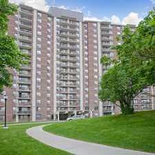
Residences are split between high rises and single detached homes, which account for almost ninety percent of all residences.
Transportation
The neighbourhood is served by Toronto Transit Commission bus routes. These include the 54 Lawrence East, (which predominantly serves the area) 102 Markham Road, 9 Bellamy, and the 16 McCowan, (the latter three connect to Warden (TTC) Station). The area is also served by three bus routes on Ellesmere Road, which are 95 York Mills 38 Highland Creek, and the 133 Neilson (the latter two serve the Scarborough Centre (TTC) Station). The area is also served by Highway 401 which runs through Toronto from east-to-west.