
OS grid reference NZ150320 Local time Tuesday 11:13 PM | Unitary authority Sovereign state United Kingdom Dialling code 01388 Population 690 (2011) | |
 | ||
Weather 6°C, Wind W at 13 km/h, 75% Humidity | ||
Witton-le-Wear is a small village in County Durham, North East England. It is situated on the north bank of the River Wear, 6 km (3.7 mi) to the north-west of Bishop Auckland.
Contents
- Map of Witton le Wear UK
- Geography and administration
- Location
- Etymology
- Industrial History
- Recent History
- Amenities
- Landmarks
- Notable residents
- References
Map of Witton-le-Wear, UK
Geography and administration
Witton-le-Wear is part of the North West Durham Parliamentary constituency, and is represented by Pat Glass (Labour). For European Parliament purposes the village is in the North East England constituency. The village is within Weardale Ward, which elects two councillors to Durham County Council. The current councillors are Anita Savory (Independent) and John Shuttleworth (Independent). Witton-le-Wear also has an eight-member Parish Council.
The local police force is Durham Constabulary. Witton-le-Wear is in the Wear and Tees division.
Location
Etymology
The place name Witton or Whitton is fairly common in the north of England. While the name can mean "white farm", in the case of Witton-le-Wear Witton refers to a farm (Anglo-Saxon: ton) in or near woodland (Anglo-Saxon: widu). Witton-le-Wear's name is attested as Wudeton from 1104, but had become Wotton in Werdale by 1313. This subsequently evolved to the present form.
Industrial History
The farming hamlet of Witton-le-Wear was part of the Witton Castle estate, which was bought in 1816 by Sir William Chaytor for £78,000 from the Stobart family. He redeveloped the castle, and in 1819 developed the Jayne Pitt as part of the large Witton Park Colliery complex. This brought about the development of transport into the area, including the Etherley Incline Railway by George Stephenson, that connected to the Stockton and Darlington Railway (S&DR) at Shildon, and hence onwards via Stockton to Newport on the River Tees.
After the S&DR was extended into Bishop Auckland, the railway was able to access the limestone deposits within the upper River Wear valley. This brought employment to the valley through both mining, as well as production of both pig iron and cement, which was distributed by the railway to all parts of the United Kingdom.
Recent History
As the price of road haulage dropped, the railway fell into disuse and carried its last train in the early 1990s. Over recent years the Weardale Railway has been reinstated by the British American Railway Services (BARS) and is again used to transport locally mined opencast coal to Scunthorpe and Ratcliffe Power Station.
The line is also run as a heritage railway, operating on many weekends and holidays by Weardale Railway Trust in conjunction with the BARS, and provides a tourist route in and out of Weardale. A weekend halt has been provided at Witton-le-Wear since early 2013.
Amenities
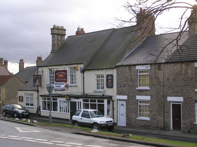
Witton-le-Wear's last village shop closed in 1998, meaning the village's only permanent amenities are its two public houses, The Dun Cow and the Victoria. There are two churches, the Anglican Church of St Philip and St James, and the Primitive Methodist Chapel. The two churches share a congregation and use each building alternately for services. Witton's original Board School was erected in 1874, and replaced in 1968 with a new primary school in St James Gardens. [1] There are around 100 pupils attending from Witton-le-Wear and surrounding villages. The original school now provides a Community Centre for the village which is used most days by a variety of groups and organisations.
Witton Castle Country Park is situated over the River Wear from the village and consists of a 15th-century castle and grounds.[2]
Landmarks
In the village is Witton Tower, a medieval pele tower with later additions. The village green has been a major feature of the village for over 200 years. The trees along the top were planted to celebrate Queen Victoria's Diamond Jubilee in 1897. Further trees have been added to celebrate the Silver and Golden Jubilees of Queen Elizabeth II and other important occasions.