
OS grid reference SU100720 Unitary authority Dialling code 01672 Population 160 (in 2011) | Civil parish Winterbourne Monkton Sovereign state United Kingdom Postcode district SN4 | |
 | ||
Winterbourne Monkton is a small village and civil parish in Wiltshire, England, about 1 mile (1.6 km) north of Avebury Stone Circle and 6 miles (10 km) northwest of Marlborough.
Contents
Map of Winterbourne Monkton, Swindon, UK
The eastern boundary of the parish is the ancient trackway known as The Ridgeway.
Local government
Winterbourne Monkton elects a joint parish council with the adjacent parish of Berwick Bassett. It falls within the area of the Wiltshire Council unitary authority, which is responsible for all significant local government functions.
Parish church
The Church of England parish church of St Mary Magdalen is Grade II listed. The church has 12th-century origins but was rebuilt in 1878 by William Butterfield.
Amenities
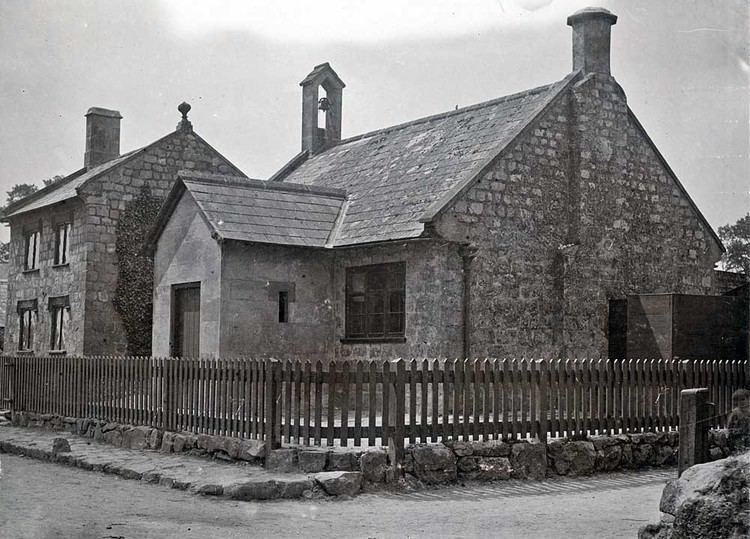
A National School was built in 1847 and educated children of all ages until 1949. It became a Church of England primary school which closed in 1971; local children go to Broad Hinton or Lockeridge.
The village had a pub, the New Inn, which closed in 2012.