
Population 291 (in 1991) Sovereign state United Kingdom Local time Sunday 12:30 AM | OS grid reference SU148678 Dialling code 01672 | |
 | ||
Weather 8°C, Wind S at 6 km/h, 95% Humidity | ||
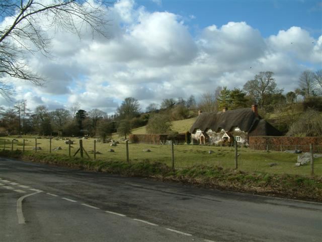
Lockeridge (pop. approximately 290) is a village in Wiltshire, England. It lies at the edge of the West Woods in the Kennet Valley, 2.9 miles (4.7 km) west of Marlborough, 3.1 miles (5.0 km) east of Avebury and 10.5 miles (16.9 km) south of Swindon. It is 0.6 miles (0.97 km) south of the A4 road which was historically the main route from London to the west of England.
Contents
Map of Lockeridge, Marlborough, UK
Lockeridge Dene is a hamlet immediately southwest of the village.
Lockeridge and its surroundings have provided evidence of Stone and Bronze Age activity in the area. Field enclosures close to the village indicate Roman occupation, whilst the village itself appears in the Domesday Book of 1086.
Lockeridge today forms an agricultural and commuter community with no local industry. The community is served by a village pub, the Who'd a Thought It, but has no other services.
History
The area has extensive evidence of Neolithic settlement and a Bronze Age burial site was discovered behind the school in the 19th century. Field enclosures on White Hill (a ridge above the village) provide evidence of Roman occupation probably linked to the nearby fortress town of Cunetio. One possible derivation of the name is from the Old English composite word loc(a)-hrycg meaning "a ridge marked by enclosure(s)".
At the time of the Domesday Book of 1086, Lockeridge was owned by Durand of Gloucester and is described as follows: Durand himself holds LOCKERIDGE. Almær held it TRE, and it paid geld for 2 hides. There is land for 1 plough. Of this 1 hide is in demesne. There is 1 villan and 2 bordars with 1 slave, and 1-acre (4,000 m2) of meadow, and 12 acres (4.9 ha) of pasture and 6 acres (2.4 ha) of woodland. It was worth 40s ; now 30s. These two late Anglo-Saxon estates are held to be linked to the cluster of houses at Lockeridge Dene at the southern end of the village, and the eighteenth-century Lockeridge House at the northern end. Lockeridge House is adjacent to Piper's Lane, remnant of a Roman road.
Building took place between the two Saxon settlements in the 12th century on the order of the Knights Templar who acquired one of the estates between 1141 and 1143. In 1155–1156 it acquired land in Rockley to build a Preceptory. Lockeridge is therefore something rare in Britain, namely a planned Templar village. The collapse of the nearby settlement of Shaw as a result of the Plague may have triggered growth as Lockeridge was situated at an intersection of a major east-west route (now the A4) and a crossing of the Pewsey Downs. The Templar link explains the absence (rare in Wiltshire villages) of a church.
Lockeridge House was built c. 1740 and is Grade II* listed.
The settlement expanded from a hamlet to a village in the 1870s when Sir Henry Meux sited his estate office (Gypsy Furlong) and the estate yard (Yardacre) in the village. Houses, a school and a pub were built at the same time.
In consequence of this history there are three main architectural styles in the village.
Governance
Lockeridge forms part of the civil parish of West Overton, which elects a joint parish council with the adjacent parish of Fyfield; the council is named Fyfield and West Overton. It falls within the area of the Wiltshire Council unitary authority, which is responsible for all significant local government functions.
Landmarks
Lockeridge Dene at the south end of the village is a National Trust site and is a conservation area. Sarsen stones are scattered over the area and this is one of the sites from which the stones at Avebury were mined.
The village is adjacent to the nearby West Woods. In the spring these are carpeted with bluebells and provide a tourist attraction with the woods being opened to vehicles on two weekends.
Walks from the village lead through the West Woods onto the Pewsey Downs and the Wansdyke, an early medieval earthwork that ran from near Andover to the Bristol Channel and became the border between the Anglo-Saxon kingdoms of Mercia and Wessex.
Transport
The village is served by an "on demand" bus service.
Education
The Kennet Valley Church of England Primary School was consolidated from two locations in July 2011. A single-site school for 4- to 11-year-olds was created by extending the 1872 school building designed by Charles Ponting. For secondary education most children go on to St John's, Marlborough.
Sports
The Kennet Valley Cricket Club plays in the village comprising residents of Lockeridge along with those of West Overton, East Kennett and Fyfield. It also hosts an annual New Years Day football and Rugby match between the west and east of the Kennet Valley for the Baliszewski Cup (named after the founder of the tradition, Edward Baliszewski, who died in 2008). Played by all ages, to ad hoc rules including two simultaneous football matches played with two balls on the same pitch; men may only play with one ball, women and children with either.