
- location Wingan Swamp Source Mount Future | Mouth Bass Strait Mouth elevation 0 | |
 | ||
- left Yoke Up Creek, Hard To Seek Creek - right Scrubby Creek, Karlo Creek, Dingo Creek (Victoria), Scudder Creek, Surprise Creek, Branch Creek (Victoria) | ||
The Wingan River is a perennial river with no defined major catchment, located in the East Gippsland region of the Australian state of Victoria.
Contents
Map of Wingan River, VIC, Australia
Course and features
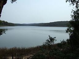
The Wingan River rises below Mount Future, near the Wingan Swamp, north of the Alfred National Park between Cann River and Genoa, and flows generally south through the Croajingolong National Park joined by eight minor tributaries before reaching its mouth with Bass Strait, at the Wingan Inlet within the Wingan Inlet National Park in the Shire of East Gippsland. The river descends 188 metres (617 ft) over its 49 kilometres (30 mi) course.
The upper reaches of the river is traversed by the Princes Highway.
Etymology
The name of the river is derived from the Aboriginal word wangan, meaning "reed bed".
References
Wingan River Wikipedia(Text) CC BY-SA