
Population 169 (2011 census) Postal code 3890 | Postcode(s) 3890 Elevation 97 m Local time Wednesday 5:13 PM | |
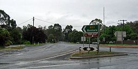 | ||
Location 461 km (286 mi) E of Melbourne88 km (55 mi) E of Orbost96 km (60 mi) S of Bombala298 km (185 mi) S of Canberra114 km (71 mi) SE of Eden Weather 21°C, Wind E at 18 km/h, 53% Humidity | ||
Cann River is a town in the East Gippsland region of Victoria in Australia. The town is located on the Cann River at the junction of the Princess Highway and the Monaro Highway, in the Shire of East Gippsland. At the 2011 census, Cann River had a population of 169 people.
Contents
Map of Cann River VIC 3890, Australia
Features
The town is close to the Lind, Coopracambra, Croajingolong, and Alfred national parks, and is a popular stopping point for travellers between Melbourne and Sydney using the Princes Highway route. Public transport services are provided to the town by V/Line, a coach bus service between Canberra and Bairnsdale, that operates three times per week.
The post office opened on 1 July 1890.
References
Cann River, Victoria Wikipedia(Text) CC BY-SA