
Topo map USGS Hensonville Prominence 227 m | Elevation 1,074 m | |
 | ||
Similar Blackhead, Black Dome, Thomas Cole Mountain, Indian Head Mountain, West Kill Mountain | ||
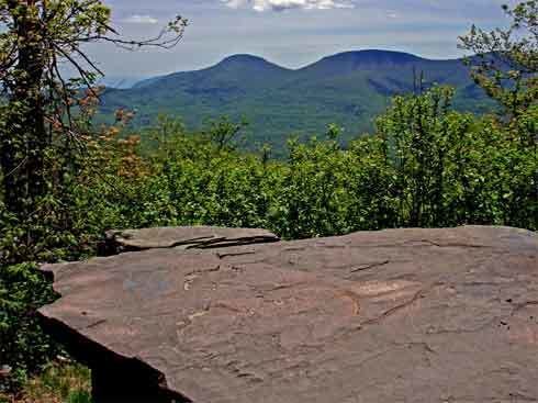
Windham high peak 9 26 15
Windham High Peak is a mountain located in Greene County, New York. The mountain is part of the Catskill Mountains.
Contents
- Windham high peak 9 26 15
- Map of Windham High Peak Windham NY 12439 USA
- Hiking blackhead mountain via windham high peak and acra point catskill mountains
- References
Map of Windham High Peak, Windham, NY 12439, USA
Windham High Peak stands within the watershed of the Hudson River, which drains into New York Bay. The south and northwest sides of Windham drain into Batavia Kill, and thence into Schoharie Creek, the Mohawk River, and the Hudson River. The northeast side of Windham drains into Bowery Creek, thence into Catskill Creek, and the Hudson River.
Windham High Peak is within New York's Catskill Park. The Long Path, a 350-mile (560 km) long-distance hiking trail from New York City to Albany, is contiguous with the Escarpment Trail.
Hiking blackhead mountain via windham high peak and acra point catskill mountains
References
Windham High Peak Wikipedia(Text) CC BY-SA