
Built 1884 Architectural style Howe Truss Added to NRHP November 9, 1981 | Architect Joseph J. Daniels NRHP Reference # 81000018 | |
 | ||
Nearest city | ||
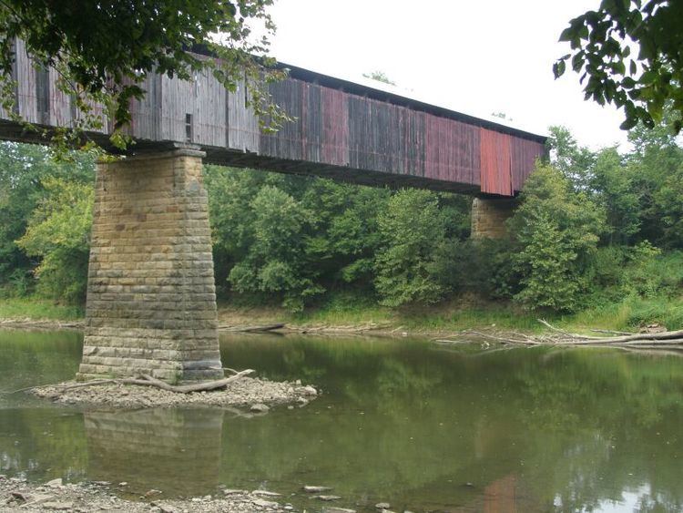
The Williams Bridge is a wooden covered bridge built in 1884 and is located in southern Indiana.
Contents
Map of Williamsbridge, Bronx, NY, USA
Location
The Williams Bridge is located in Spice Valley Township in Lawrence County, Indiana and crosses the East Fork of the White River on Huron and Williams Road, south of State Road 450. It is near the unincorporated town of Williams, about two miles downriver from the Williams Dam and eight miles southwest of Bedford.
Construction
The bridge is a Howe Truss design and was built in 1884 by Joseph 'J.J.' Daniels. Its two spans cover a total length of 373 feet (114 m), with a deck width of 14.7 feet (4.5 m) and a vertical clearance above deck of 19.2 feet (5.9 m).
History
In 1981, the bridge was added to the National Register of Historic Places. It was the longest covered bridge in Indiana that was still open to vehicular traffic. The bridge was closed to traffic around September 20, 2010. The Medora Bridge at 434 feet (132 m), in Jackson County, remains the longest covered bridge in the state, but it was closed to all but pedestrian traffic in 1972.