
Topo map USGS Highlands Prominence 219 m | Elevation 1,503 m Mountain range Appalachian Mountains | |
 | ||
Similar Devil's Courthouse, Looking Glass Rock, Table Rock, Black Balsam Knob, Mount Mitchell | ||
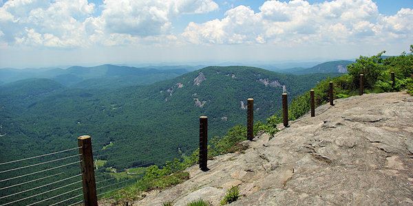
Whiteside mountain highlands north carolina
Whiteside Mountain is a mountain in Jackson County, North Carolina between Cashiers, Highlands, North Carolina, and the Georgia border. Whiteside Mountain can boast the highest cliffs in Eastern North America. It also has a feature called Devil's Courthouse, not to be confused with the Devil's Courthouse 20 miles away in Transylvania County, NC.
Contents
- Whiteside mountain highlands north carolina
- Map of Whiteside Mountain Cashiers NC 28741 USA
- For sale 1706 whiteside mountain road highlands nc 28741 mls 76469
- History
- Legend of Spear Finger
- Legend of De Soto
- References
Map of Whiteside Mountain, Cashiers, NC 28741, USA
Since the 1980s, the forest service has tried to restrict access to the Courthouse and has allowed the foot trail to it to grow over because of dangers such as strong winds. They also did not want accidents from paragliding and similar activities taking place from the mountain top or from the Courthouse. There is also an overhang, a small platform less than 7 feet in diameter, connected to Whiteside as if it were a cantilever. Similar overhangs can be found on the Appalachian Trail.
For sale 1706 whiteside mountain road highlands nc 28741 mls 76469
History
The Cherokee name for Whiteside mountain is Sanigilâ'gĭ.
Legend of Spear Finger
Cherokee myth says that Spear-finger, the powerful woman monster, built a bridge from the Hiwassee River to Whiteside Mountain.
Legend of De Soto
The overhanging edge has a message carved into it, which reads that Hernando de Soto was there and that it was carved by his men who allegedly threw over their sick, crippled horses there. However, it is likely a hoax carved by some boys sometime in 1926 when there was probably much more of the overhang than there is today. Since the terrain is too rough for men and horses to get through, for De Soto to have come through here at a time when there were no roads or pathways is unlikely. De Soto's route most likely took him through the Cumberland Gap from South Carolina.