Country Canada Established 1821 (HBC post) Time zone EST (UTC-5) Area 202.5 km² Postal Code J0M 1G0 Area code 819 | Region Eeyou Istchee Incorporated 1979 Website www.whapmagoostuifn.ca Population 812 (2006) Province Québec | |
 | ||
Weather -5°C, Wind SW at 23 km/h, 91% Humidity | ||
The n we jinan tour 2016 whapmagoostui qc episode 9
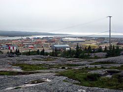
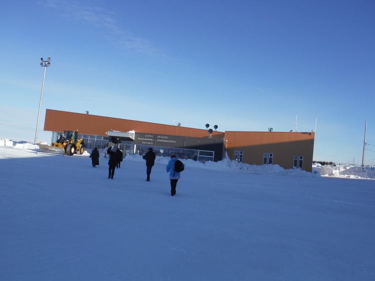
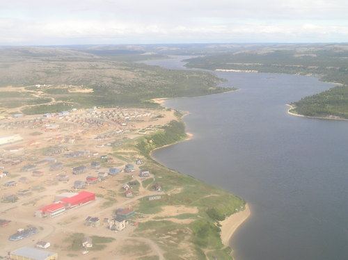
Whapmagoostui (Cree: ᐙᐱᒫᑯᔥᑐᐃ/Wâpimâkuštui, "place of the beluga") is the northernmost Cree village in Quebec, Canada, located at the mouth of the Great Whale River (French: Grande Rivière de la Baleine) on the coast of Hudson Bay in Nunavik. About 906 Cree with about 650 Inuit, living in the neighbouring village of Kuujjuarapik. The community is only accessible by air (Kuujjuarapik Airport) and, in late summer, by boat. Whapmagoostui is about 250 kilometres north of the nearest Cree village, Chisasibi.
Contents
Although the permanent cohabitation of Inuit and Crees at the mouth of the Great Whale River only goes back to the year 1950, the two nations were rubbing shoulders in this area for a very long time; Inuit close to the coast and the Crees more in the interior lands.
History

While the Cree have hunted and fished along the Hudson Bay coast long before the arrival of Europeans, it was not until 1820 when a Hudson's Bay Company trading post was built here, known variously as Great Whale River House, Great Whale River or just Great Whale. On maps of 1851 and 1854, the post is called Whale River House and Whale House. Protestant and Catholic missions settled there in the 1880s. In 1895, a weather station was set up by the Federal Government. Medical and police services began to be offered in the first half of the 20th century. Yet the Cree would not settle here permanently and only used it as a summer encampment.
Not until 1940 did the Cree give up their nomadic way of life when the American army opened a military air base here, using Inuit and Cree workers. In 1941, the HBC post closed. After the World War II in 1948, the military base was transferred to the Canadian government. And in 1955, it began operating a Mid-Canada Line radar station. Though the radar station was not operational for long and closed in 1965, it established the village permanently.
In 1961, when the Quebec Government decided to give French names to northern settlements, the name Great Whale River was replaced with Grande-Baleine which itself was replaced a year later with Poste-de-la-Baleine. In 1979, the Cree Village Municipality, identified as Whapmagoostoo, was established. The Cree village itself was officially named Whapmagoostui in 1986, from then on replacing all other toponyms.
In 2013, seven young men from the community journeyed 1600 km for "Nishiyuu", in support of Idle No More.
Demographics
Population: