
Congressional district 4th Website www.wexfordcounty.org Founded 1840 | Area 1,489 km² Population 32,645 (2013) | |
 | ||
Colleges and Universities Baker College of Cadillac, Cadillac Institute-Cosmetology Points of interest Lake Cadillac, Mitchell State Park, Adventure Island, Wexford County Historical, Manton Area Historical | ||
Wexford County is a county located in the U.S. state of Michigan. As of the 2010 census, the population was 32,735. The county seat is Cadillac.
Contents
- Map of Wexford County MI USA
- History
- Geography
- Major highways
- Adjacent counties
- National protected area
- Demographics
- Government
- Elected officials
- Politics
- Tourism
- Cities
- Villages
- Census designated places
- Other unincorporated communities
- Historical markers
- References
Map of Wexford County, MI, USA
Wexford County is part of the Cadillac, MI Micropolitan Statistical Area, which also includes Missaukee County. It is considered to be part of Northern Michigan.
The county is also known for being the location of the first known sighting of the Michigan dogman.
History
The county was established by the Michigan Legislature in 1840 as Kautawaubet County, after a Potawatomi phrase meaning "broken tooth" and the name of an area Potawatomi chief. In 1843, legislators renamed the county Wexford, after County Wexford in Ireland. It was formally organized in 1869.
Geography
According to the U.S. Census Bureau, the county has a total area of 575 square miles (1,490 km2), of which 565 square miles (1,460 km2) is land and 10 square miles (26 km2) (1.8%) is water.
Major highways
Bus. US 131
Bus. US 131
Adjacent counties
National protected area
Demographics
As of the census of 2000, there were 30,484 people, 11,824 households, and 8,383 families residing in the county. The population density was 54 people per square mile (21/km²). There were 14,872 housing units at an average density of 26 per square mile (10/km²). The racial makeup of the county was 97.29% White, 0.19% Black or African American, 0.74% Native American, 0.42% Asian, 0.03% Pacific Islander, 0.24% from other races, and 1.09% from two or more races. 1.01% of the population were Hispanic or Latino of any race. 21.4% were of German, 11.3% English, 9.5% American, 9.4% Irish, 6.1% Dutch, 5.8% Swedish and 5.3% Polish ancestry according to Census 2000. 97.7% spoke English and 1.1% Spanish as their first language.
There were 11,824 households out of which 33.60% had children under the age of 18 living with them, 56.20% were married couples living together, 10.30% had a female householder with no husband present, and 29.10% were non-families. 24.20% of all households were made up of individuals and 10.10% had someone living alone who was 65 years of age or older. The average household size was 2.55 and the average family size was 3.00.
In the county, the population was spread out with 26.80% under the age of 18, 7.70% from 18 to 24, 28.10% from 25 to 44, 23.40% from 45 to 64, and 14.00% who were 65 years of age or older. The median age was 37 years. For every 100 females there were 98.10 males. For every 100 females age 18 and over, there were 93.80 males.
The median income for a household in the county was $35,363, and the median income for a family was $39,915. Males had a median income of $31,198 versus $21,733 for females. The per capita income for the county was $17,144. About 7.70% of families and 10.30% of the population were below the poverty line, including 11.50% of those under age 18 and 8.50% of those age 65 or over.
Government
The county government operates the jail, maintains rural roads, operates the major local courts, keeps files of deeds and mortgages, maintains vital records, administers public health regulations, and participates with the state in the provision of welfare and other social services. The county board of commissioners controls the budget but has only limited authority to make laws or ordinances. In Michigan, most local government functions — police and fire, building and zoning, tax assessment, street maintenance, etc. — are the responsibility of individual cities and townships.
Elected officials
(information as of September 2005)
Politics
The county is one of the few counties to have given majorities to both the first Republican candidate, John C. Frémont, and to John McCain. That stated, the county went for Bill Clinton twice.
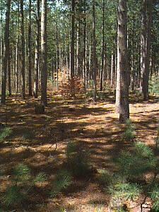
Tourism
There are many attractions and hot spots in Wexford County. The Manistee National Forest is one recreation site. The Manistee River is used by fishermen, kayakers, and canoers.
Cities
Villages
Census-designated places
Other unincorporated communities
Historical markers
There are ten recognized Michigan historical markers in the county: They are: