
Country United States County Wexford FIPS code 26-11480 Elevation 320 m Population 694 (2013) Area code 231 | Time zone Eastern (EST) (UTC-5) GNIS feature ID 2397486 Zip code 49620 Local time Sunday 6:50 PM | |
 | ||
Weather 6°C, Wind SE at 14 km/h, 56% Humidity Area 4.766 km² (4.61 km² Land / 16 ha Water) | ||
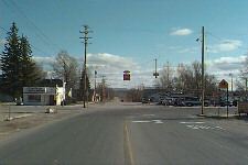
Buckley is a village in Wexford County in the U.S. state of Michigan. The population was 697 at the 2010 census. The village is located in the northwest part of Hanover Township on M-37. It was established in 1905. The Buckley post office first opened March 31, 1906.
Contents
Map of Buckley, MI 49620, USA
Geography
According to the United States Census Bureau, the village has a total area of 1.84 square miles (4.77 km2), of which 1.78 square miles (4.61 km2) is land and 0.06 square miles (0.16 km2) is water.
2010 census
As of the census of 2010, there were 697 people, 246 households, and 175 families residing in the village. The population density was 391.6 inhabitants per square mile (151.2/km2). There were 300 housing units at an average density of 168.5 per square mile (65.1/km2). The racial makeup of the village was 95.3% White, 0.7% African American, 0.9% Native American, 0.1% Asian, 0.9% Pacific Islander, 0.1% from other races, and 2.0% from two or more races. Hispanic or Latino of any race were 2.0% of the population.
There were 246 households of which 42.7% had children under the age of 18 living with them, 51.6% were married couples living together, 16.7% had a female householder with no husband present, 2.8% had a male householder with no wife present, and 28.9% were non-families. 20.3% of all households were made up of individuals and 3.6% had someone living alone who was 65 years of age or older. The average household size was 2.83 and the average family size was 3.23.
The median age in the village was 30.2 years. 31.3% of residents were under the age of 18; 8% were between the ages of 18 and 24; 32% were from 25 to 44; 21.4% were from 45 to 64; and 7.2% were 65 years of age or older. The gender makeup of the village was 50.2% male and 49.8% female.
2000 census
As of the census of 2000, there were 550 people, 185 households, and 145 families residing in the village. The population density was 309.4 per square mile (119.3/km²). There were 212 housing units at an average density of 119.3 per square mile (46.0/km²). The racial makeup of the village was 93.64% White, 0.73% African American, 2.36% Native American, 0.36% Asian, 1.27% from other races, and 1.64% from two or more races. Hispanic or Latino of any race were 3.64% of the population.
There were 185 households out of which 42.7% had children under the age of 18 living with them, 61.1% were married couples living together, 12.4% had a female householder with no husband present, and 21.1% were non-families. 13.0% of all households were made up of individuals and 4.9% had someone living alone who was 65 years of age or older. The average household size was 2.94 and the average family size was 3.18.
In the village, the population was spread out with 31.5% under the age of 18, 10.0% from 18 to 24, 31.5% from 25 to 44, 18.9% from 45 to 64, and 8.2% who were 65 years of age or older. The median age was 31 years. For every 100 females there were 91.0 males. For every 100 females age 18 and over, there were 94.3 males.
The median income for a household in the village was $36,667, and the median income for a family was $37,212. Males had a median income of $28,750 versus $19,167 for females. The per capita income for the village was $14,258. About 5.2% of families and 7.3% of the population were below the poverty line, including 4.7% of those under age 18 and 13.6% of those age 65 or over.